UN
7 Ewart Road
£ 145,000
Description
We don't have a Description for this property.
- Bedrooms
- 2
- Bathrooms
- 0
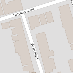

Leaflet © OpenStreetMap contributors
The heatmap indicates the level of crime in the area. The color of the heatmap indicates the crime severity and recency.
Metrics Year-on-Year
- Average area value
- 219,087.00 £Increased by 3.80 %
- Average area rental value
- 1,235.00 £/moIncreased by 9.49 %
- Est rental Yield
- 6.76 %Increased by 5.46 %
- Crime Rate
- 7.00 %Unchanged by 0.00 %
from 211,069.00 £
from 1,128.00 £/mo
from 6.41 %
from 7.00 %
Nearby Schools
| Name | Type | Ofsted | Distance |
|---|---|---|---|
| Newbridge Junior School | Academy Converter | Good | 0.38 KM |
| Manor Infant And Nursery School | Community School | Good | 0.39 KM |
| The Portsmouth Academy | Academy Sponsor Led | Good | 0.51 KM |
| North End And Willows Children'S Centre | Children's Centre | 0.58 KM | |
| Madani Academy | Other Independent School | Good | 0.65 KM |
Images
Nearby Streets
| Name | Average Price | Average Sqft | Distance |
|---|---|---|---|
| Fourth Street | £ 0 | 0 | 0.00 KM |
| Drayton Road | £ 297,500 | 0 | 0.00 KM |
| Emsworth Road | £ 229,995 | 0 | 0.00 KM |
| Trafalgar Place | £ 0 | 0 | 0.00 KM |
| Watts Road | £ 240,000 | 0 | 0.00 KM |
Nearby Transport
| Name | NLC | TLC | Distance |
|---|---|---|---|
| Fratton | 5509 | FTN | 1.30 KM |
| Portsmouth And Southsea | 5537 | PMS | 2.32 KM |
| Hilsea | 5539 | HLS | 2.71 KM |
| Cosham | 5896 | CSA | 3.82 KM |
| Portsmouth Harbour | 5540 | PMH | 4.13 KM |
Nearby Listings
| Address | Price | Type | Score | Distance |
|---|---|---|---|---|
| Ewart Road, Fratton | £ 115,000 | BUY | Unknown | 0.00 KM |
| Ewart Road, Portsmouth, Hampshire, PO1 | £ 270,000 | BUY | 7 / 10 | 0.00 KM |
| Shearer Road, Fratton, PO1 | £ 230,000 | BUY | 5 / 10 | 0.06 KM |
| Harcourt Road, Portsmouth, Hampshire, PO1 | £ 270,000 | BUY | 7 / 10 | 0.06 KM |
| Harcourt Road, Portsmouth, Hampshire, PO1 | £ 260,000 | BUY | 7 / 10 | 0.08 KM |
Nearby Properties
| Address | Price | Distance |
|---|---|---|
| 15 Ewart Road | £ 85,050 | 0.00 KM |
| 17 Ewart Road | £ 223,000 | 0.00 KM |
| 11a Ewart Road | £ 198,000 | 0.00 KM |
| 23 Ewart Road | £ 230,000 | 0.00 KM |
| 2 Ewart Road | £ 138,000 | 0.00 KM |