UN
Jesmondene
£ 725,000
Description
We don't have a Description for this property.
- Bedrooms
- 3
- Bathrooms
- 0
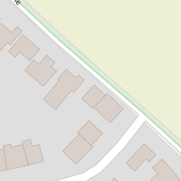


Leaflet © OpenStreetMap contributors
The heatmap indicates the level of crime in the area. The color of the heatmap indicates the crime severity and recency.
Metrics Year-on-Year
- Average area value
- 257,097.00 £Decreased by 8.25 %
- Average area rental value
- 956.00 £/moIncreased by 1.92 %
- Est rental Yield
- 4.46 %Increased by 10.95 %
- Crime Rate
- 28.00 %Unchanged by 0.00 %
from 280,201.00 £
from 938.00 £/mo
from 4.02 %
from 28.00 %
Nearby Schools
| Name | Type | Ofsted | Distance |
|---|---|---|---|
| Charing Church Of England Primary School | Academy Converter | 0.74 KM | |
| Bluebells Children'S Centre | Children's Centre | 4.64 KM | |
| Heath Farm School | Other Independent Special School | Good | 4.69 KM |
| Goldwyn School | Foundation Special School | Outstanding | 6.36 KM |
| Pluckley Church Of England Primary School | Academy Converter | Good | 6.40 KM |
Images
Nearby Streets
| Name | Average Price | Average Sqft | Distance |
|---|---|---|---|
| The Hill | £ 975,000 | 0 | 0.00 KM |
| Alderbed Close | £ 650,000 | 0 | 0.00 KM |
| Downs Close | £ 0 | 0 | 0.00 KM |
| Blackberry Lane | £ 465,000 | 0 | 0.00 KM |
| Wicken Lane | £ 0 | 0 | 0.00 KM |
Nearby Transport
| Name | NLC | TLC | Distance |
|---|---|---|---|
| Charing (Kent) | 5097 | CHG | 1.05 KM |
| Pluckley | 5225 | PLC | 8.29 KM |
Nearby Listings
| Address | Price | Type | Score | Distance |
|---|---|---|---|---|
| Pett Lane, Charing | £ 499,995 | BUY | 6 / 10 | 0.00 KM |
| Woodbrook, Charing, Ashford TN25 | £ 425,000 | BUY | 6 / 10 | 0.07 KM |
| Woodbrook, Charing | £ 450,000 | BUY | 7 / 10 | 0.07 KM |
| Archbishop's Palace, Charing, Kent | £ 950,000 | BUY | 5 / 10 | 0.42 KM |
| The Moat, Charing, Ashford, TN27 | £ 475,000 | BUY | 5 / 10 | 0.42 KM |
Nearby Properties
| Address | Price | Distance |
|---|---|---|
| 52 Pett Lane | £ 250,000 | 0.00 KM |
| 50 Pett Lane | £ 154,000 | 0.00 KM |
| Copperfields | £ 227,500 | 0.00 KM |
| Silver Birches | £ 910,000 | 0.00 KM |
| 44 Pett Lane | £ 155,000 | 0.00 KM |