UN
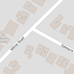
24 Milner Road
£ 295,000
Description
We don't have a Description for this property.
- Bedrooms
- 2
- Bathrooms
- 0

Leaflet © OpenStreetMap contributors
The heatmap indicates the level of crime in the area. The color of the heatmap indicates the crime severity and recency.
Metrics Year-on-Year
- Average area value
- 355,329.00 £Decreased by 12.56 %
- Average area rental value
- 1,374.00 £/moIncreased by 19.48 %
- Est rental Yield
- 4.64 %Increased by 36.47 %
- Crime Rate
- 16.00 %Unchanged by 0.00 %
from 406,350.00 £
from 1,150.00 £/mo
from 3.40 %
from 16.00 %
Nearby Schools
| Name | Type | Ofsted | Distance |
|---|---|---|---|
| Joy Lane Primary Foundation School | Foundation School | Good | 1.86 KM |
| Joy Lane Children'S Centre | Children's Centre | 1.95 KM | |
| St Alphege Church Of England Infant School | Voluntary Controlled School | Good | 2.98 KM |
| Whitstable Junior School | Foundation School | Good | 3.01 KM |
| Whitstable And Seasalter Endowed Church Of England Junior School | Voluntary Aided School | Outstanding | 3.21 KM |
Images
Nearby Streets
| Name | Average Price | Average Sqft | Distance |
|---|---|---|---|
| Freeman's Close | £ 0 | 0 | 0.00 KM |
| Applegarth Park | £ 153,408 | 0 | 0.00 KM |
| Church Court | £ 740,000 | 0 | 0.00 KM |
| Sunray Avenue (CW75) | £ 300,000 | 0 | 0.00 KM |
| Croft View | £ 550,000 | 0 | 0.00 KM |
Nearby Transport
| Name | NLC | TLC | Distance |
|---|---|---|---|
| Whitstable | 5196 | WHI | 3.94 KM |
| Chestfield And Swalecliffe | 5200 | CSW | 7.60 KM |
Nearby Listings
| Address | Price | Type | Score | Distance |
|---|---|---|---|---|
| Milner Road, Seasalter, Whitstable, Kent | £ 425,000 | BUY | 6 / 10 | 0.01 KM |
| Milner Road, Seasalter, Whitstable | £ 450,000 | BUY | 7 / 10 | 0.02 KM |
| Kimberley Grove, Seasalter, Whitstable | £ 550,000 | BUY | Unknown | 0.16 KM |
| Faversham Road, Seasalter, Whitstable | £ 419,950 | BUY | Unknown | 0.19 KM |
| Ashley Drive, Seasalter, Whitstable, Kent | £ 450,000 | BUY | 7 / 10 | 0.20 KM |
Nearby Properties
| Address | Price | Distance |
|---|---|---|
| 19 Milner Road | £ 290,000 | 0.00 KM |
| 26 Milner Road | £ 365,000 | 0.00 KM |
| 9 Milner Road | £ 58,000 | 0.00 KM |
| 29 Milner Road | £ 345,000 | 0.00 KM |
| 15 Milner Road | £ 269,995 | 0.00 KM |