UN
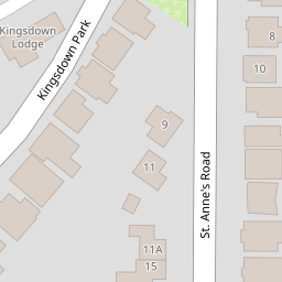
17 St Annes Road
£ 489,950
Description
We don't have a Description for this property.
- Bedrooms
- 4
- Bathrooms
- 0

Leaflet © OpenStreetMap contributors
The heatmap indicates the level of crime in the area. The color of the heatmap indicates the crime severity and recency.
Metrics Year-on-Year
- Average area value
- 975,000.00 £Increased by 29.96 %
- Average area rental value
- 1,098.00 £/moDecreased by 33.70 %
- Est rental Yield
- 1.35 %Decreased by 49.06 %
- Crime Rate
- 17.00 %Unchanged by 0.00 %
from 750,202.00 £
from 1,656.00 £/mo
from 2.65 %
from 17.00 %
Nearby Schools
| Name | Type | Ofsted | Distance |
|---|---|---|---|
| St Mary'S Catholic Primary School, Whitstable | Academy Converter | Good | 0.46 KM |
| The Whitstable School | Academy Converter | 1.35 KM | |
| Westmeads Community Infant School | Community School | Outstanding | 1.42 KM |
| Swalecliffe Community Primary School | Foundation School | Good | 1.82 KM |
| Swalecliffe Children'S Centre | Children's Centre Linked Site | 1.86 KM |
Images
Nearby Streets
| Name | Average Price | Average Sqft | Distance |
|---|---|---|---|
| Juniper Close | £ 595,000 | 0 | 0.00 KM |
| Tower Road | £ 0 | 0 | 0.00 KM |
| Nursery Close | £ 0 | 0 | 0.00 KM |
| Northwood Road | £ 449,995 | 0 | 0.00 KM |
| Linden Avenue | £ 555,000 | 0 | 0.00 KM |
Nearby Transport
| Name | NLC | TLC | Distance |
|---|---|---|---|
| Whitstable | 5196 | WHI | 1.14 KM |
| Chestfield And Swalecliffe | 5200 | CSW | 2.75 KM |
| Herne Bay | 5174 | HNB | 8.36 KM |
| Canterbury West | 5007 | CBW | 9.47 KM |
Nearby Listings
| Address | Price | Type | Score | Distance |
|---|---|---|---|---|
| Tankerton Road, Whitstable | £ 240,000 | BUY | Unknown | 0.11 KM |
| Fitzroy Road, Tankerton, Whitstable | £ 575,000 | BUY | Unknown | 0.14 KM |
| Fitzroy Road, Tankerton, Kent | £ 650,000 | BUY | Unknown | 0.14 KM |
| Fitzroy Road, Tankerton, CT5 | £ 675,000 | BUY | 6 / 10 | 0.14 KM |
| Fitzroy Road, Tankerton, Whitstable | £ 185,000 | BUY | 5 / 10 | 0.14 KM |
Nearby Properties
| Address | Price | Distance |
|---|---|---|
| 8 St Annes Road | £ 522,000 | 0.00 KM |
| 22 St Annes Road | £ 485,000 | 0.00 KM |
| 20 St Annes Road | £ 415,000 | 0.00 KM |
| 30 St Annes Road | £ 450,000 | 0.00 KM |
| 15 St Annes Road | £ 227,000 | 0.00 KM |