UN
30 Robinson Way
£ 206,000
Description
We don't have a Description for this property.
- Bedrooms
- 3
- Bathrooms
- 0
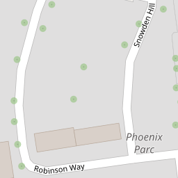
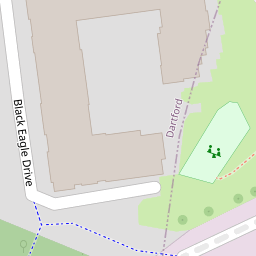

Leaflet © OpenStreetMap contributors
The heatmap indicates the level of crime in the area. The color of the heatmap indicates the crime severity and recency.
Metrics Year-on-Year
- Average area value
- 869,722.00 £Increased by 64.54 %
- Average area rental value
- 1,599.00 £/moDecreased by 40.13 %
- Est rental Yield
- 2.21 %Decreased by 63.53 %
- Crime Rate
- 25.00 %Unchanged by 0.00 %
from 528,583.00 £
from 2,671.00 £/mo
from 6.06 %
from 25.00 %
Nearby Schools
| Name | Type | Ofsted | Distance |
|---|---|---|---|
| The Ebbsfleet Academy | Academy Sponsor Led | Good | 1.02 KM |
| Swanscombe Children'S Centre | Children's Centre | 1.22 KM | |
| Manor Community Primary School | Academy Converter | Good | 1.22 KM |
| Little Gems Children'S Centre | Children's Centre | 1.58 KM | |
| Lawn Primary School | Foundation School | Good | 1.58 KM |
Images
Nearby Streets
| Name | Average Price | Average Sqft | Distance |
|---|---|---|---|
| Vernon Road | £ 0 | 0 | 0.00 KM |
| Limestone Road | £ 0 | 0 | 0.00 KM |
| Castle Hill Road | £ 450,000 | 0 | 0.00 KM |
| Ames Road | £ 451,662 | 0 | 0.00 KM |
| Village Green | £ 0 | 0 | 0.00 KM |
Nearby Transport
| Name | NLC | TLC | Distance |
|---|---|---|---|
| Ebbsfleet International | 5566 | EBD | 0.79 KM |
| Northfleet | 5120 | NFL | 0.84 KM |
| Swanscombe | 5156 | SWM | 0.89 KM |
| Grays | 7443 | GRY | 3.04 KM |
| Greenhithe For Bluewater | 5138 | GNH | 4.13 KM |
Nearby Listings
| Address | Price | Type | Score | Distance |
|---|---|---|---|---|
| Robinson Way, Northfleet, Gravesend | £ 425,000 | BUY | 6 / 10 | 0.01 KM |
| Robinson Way, Swanscombe, Kent, DA11 | £ 350,000 | BUY | Unknown | 0.02 KM |
| Griffin Court, Black Eagle Drive, Gravesend, Kent, DA11 | £ 190,000 | BUY | Unknown | 0.08 KM |
| Griffin Court, Black Eagle Drive, Gravesend, Kent, DA11 | £ 190,000 | BUY | 6 / 10 | 0.08 KM |
| Black Eagle Drive, Gravesend, DA11 | £ 210,000 | BUY | 5 / 10 | 0.09 KM |
Nearby Properties
| Address | Price | Distance |
|---|---|---|
| 23 Robinson Way | £ 208,995 | 0.00 KM |
| 27 Robinson Way | £ 210,000 | 0.00 KM |
| 3 Robinson Way | £ 250,000 | 0.00 KM |
| 10 Robinson Way | £ 224,995 | 0.00 KM |
| 14 Robinson Way | £ 335,000 | 0.00 KM |