UN
5 St Johns Road
£ 67,500
Description
We don't have a Description for this property.
- Bedrooms
- 0
- Bathrooms
- 0
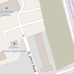


Leaflet © OpenStreetMap contributors
The heatmap indicates the level of crime in the area. The color of the heatmap indicates the crime severity and recency.
Metrics Year-on-Year
- Average area value
- 216,269.00 £Decreased by 21.21 %
- Average area rental value
- 950.00 £/moIncreased by 8.70 %
- Est rental Yield
- 5.27 %Increased by 37.96 %
- Crime Rate
- 20.00 %Unchanged by 0.00 %
from 274,489.00 £
from 874.00 £/mo
from 3.82 %
from 20.00 %
Nearby Schools
| Name | Type | Ofsted | Distance |
|---|---|---|---|
| Dover College | Other Independent School | 0.49 KM | |
| Priory Fields School | Academy Converter | Good | 0.72 KM |
| The Daisy Children'S Centre | Children's Centre Linked Site | 0.89 KM | |
| Dover Grammar School For Girls | Community School | Outstanding | 1.01 KM |
| Vale View Community School | Academy Converter | 1.02 KM |
Images
Nearby Streets
| Name | Average Price | Average Sqft | Distance |
|---|---|---|---|
| Bastion Road | £ 325,000 | 0 | 0.00 KM |
| Priory Station Approach Road | £ 349,500 | 0 | 0.00 KM |
| West Street | £ 0 | 0 | 0.00 KM |
| Wood Street | £ 210,000 | 0 | 0.00 KM |
| Belgrave Road | £ 230,000 | 0 | 0.00 KM |
Nearby Transport
| Name | NLC | TLC | Distance |
|---|---|---|---|
| Dover Priory | 5033 | DVP | 0.15 KM |
| Kearsney (Kent) | 5038 | KSN | 4.43 KM |
| Martin Mill | 5040 | MTM | 7.04 KM |
Nearby Listings
| Address | Price | Type | Score | Distance |
|---|---|---|---|---|
| Folkestone Road, Dover, CT17 | £ 150,000 | BUY | 7 / 10 | 0.07 KM |
| Malvern Road, Dover, Kent | £ 280,000 | BUY | 6 / 10 | 0.13 KM |
| Clarendon Road, Dover, CT17 | £ 350,000 | BUY | 6 / 10 | 0.15 KM |
| Clarendon Street, Dover, CT17 | £ 165,000 | BUY | 4 / 10 | 0.18 KM |
| Clarendon Street, Dover, CT17 | £ 160,000 | BUY | 5 / 10 | 0.19 KM |
Nearby Properties
| Address | Price | Distance |
|---|---|---|
| 297a London Road | £ 208,000 | 0.00 KM |
| 6 St Johns Road | £ 230,000 | 0.00 KM |
| 5 St Johns Road | £ 67,500 | 0.00 KM |
| 107 Folkestone Road | £ 300,050 | 0.06 KM |
| 6 Malvern Road | £ 92,000 | 0.13 KM |