UN
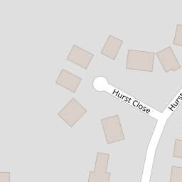
4 Hurst Close
£ 230,000
Description
We don't have a Description for this property.
- Bedrooms
- 3
- Bathrooms
- 0


Leaflet © OpenStreetMap contributors
The heatmap indicates the level of crime in the area. The color of the heatmap indicates the crime severity and recency.
Metrics Year-on-Year
- Average area value
- 582,208.00 £Increased by 22.16 %
- Average area rental value
- 2,034.00 £/moDecreased by 0.39 %
- Est rental Yield
- 4.19 %Decreased by 18.48 %
- Crime Rate
- 11.00 %Unchanged by 0.00 %
from 476,594.00 £
from 2,042.00 £/mo
from 5.14 %
from 11.00 %
Nearby Schools
| Name | Type | Ofsted | Distance |
|---|---|---|---|
| Staplehurst School | Community School | Requires improvement | 0.76 KM |
| Frittenden Church Of England Primary School | Voluntary Controlled School | Good | 5.12 KM |
| Sissinghurst Voluntary Aided Church Of England Primary School | Voluntary Aided School | Good | 6.16 KM |
| Sutton Valence Primary School | Community School | Good | 6.62 KM |
| Sutton Valence School | Other Independent School | 6.79 KM |
Images
Nearby Streets
| Name | Average Price | Average Sqft | Distance |
|---|---|---|---|
| High Street | £ 492,824 | 0 | 0.00 KM |
| Nicholsons Walk | £ 0 | 0 | 0.00 KM |
| Lodge Road | £ 0 | 0 | 0.00 KM |
| Sweetlands Lane | £ 0 | 0 | 0.00 KM |
| Crouch Road | £ 300,000 | 0 | 0.00 KM |
Nearby Transport
| Name | NLC | TLC | Distance |
|---|---|---|---|
| Staplehurst | 5228 | SPU | 0.67 KM |
| Marden (Kent) | 5223 | MRN | 6.87 KM |
| Headcorn | 5220 | HCN | 8.04 KM |
Nearby Listings
| Address | Price | Type | Score | Distance |
|---|---|---|---|---|
| Staplehurst, Kent | £ 465,000 | BUY | 7 / 10 | 0.00 KM |
| Hurst Close, Staplehurst | £ 410,000 | BUY | 5 / 10 | 0.00 KM |
| Hurst Close, Staplehurst | £ 495,000 | BUY | 6 / 10 | 0.00 KM |
| Newlyn Drive, Staplehurst, Tonbridge, Kent | £ 475,000 | BUY | 6 / 10 | 0.14 KM |
| Staplehurst,Staplehurst,Kent,TN12 0DA | £ 435,000 | BUY | 6 / 10 | 0.16 KM |
Nearby Properties
| Address | Price | Distance |
|---|---|---|
| 29 Hurst Close | £ 70,000 | 0.00 KM |
| 26 Hurst Close | £ 330,000 | 0.00 KM |
| 12 Hurst Close | £ 345,000 | 0.00 KM |
| 27 Hurst Close | £ 340,000 | 0.00 KM |
| 45 Hurst Close | £ 239,500 | 0.00 KM |