UN
36 Axwood
£ 350,000
Description
We don't have a Description for this property.
- Bedrooms
- 2
- Bathrooms
- 0
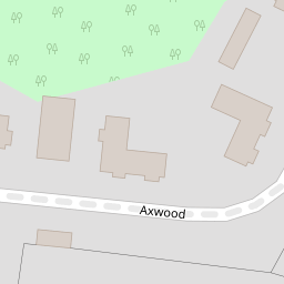

Leaflet © OpenStreetMap contributors
The heatmap indicates the level of crime in the area. The color of the heatmap indicates the crime severity and recency.
Metrics Year-on-Year
- Average area value
- 556,863.00 £Decreased by 5.50 %
- Average area rental value
- 2,877.00 £/moIncreased by 3.34 %
- Est rental Yield
- 6.20 %Increased by 9.35 %
- Crime Rate
- 1.00 %Unchanged by 0.00 %
from 589,296.00 £
from 2,784.00 £/mo
from 5.67 %
from 1.00 %
Nearby Schools
| Name | Type | Ofsted | Distance |
|---|---|---|---|
| Rosebery School | Academy Converter | Outstanding | 0.83 KM |
| St Joseph'S Catholic Primary School | Voluntary Aided School | Outstanding | 0.89 KM |
| St Martin'S Sure Start Children'S Centre | Children's Centre | 0.99 KM | |
| Kingswood House School | Other Independent School | 1.47 KM | |
| St Christopher'S School Trust (Epsom) Ltd | Other Independent School | 1.50 KM |
Images
Nearby Streets
| Name | Average Price | Average Sqft | Distance |
|---|---|---|---|
| Talbot Row | £ 675,000 | 0 | 0.00 KM |
| St. Elizabeth Drive | £ 775,000 | 0 | 0.00 KM |
| Woodcote Grove | £ 303,833 | 0 | 0.00 KM |
| St Josephs Church | £ 0 | 0 | 0.00 KM |
| White Horse Drive | £ 475,000 | 0 | 0.00 KM |
Nearby Transport
| Name | NLC | TLC | Distance |
|---|---|---|---|
| Epsom | 5360 | EPS | 1.40 KM |
| Ewell West | 5586 | EWW | 3.53 KM |
| Tattenham Corner | 5387 | TAT | 3.65 KM |
| Epsom Downs | 5361 | EPD | 3.75 KM |
| Ashtead | 5347 | AHD | 3.88 KM |
Nearby Listings
| Address | Price | Type | Score | Distance |
|---|---|---|---|---|
| Axwood, Epsom | £ 250,000 | BUY | 8 / 10 | 0.01 KM |
| Cedar Hill, Epsom | £ 1,250,000 | BUY | 7 / 10 | 0.14 KM |
| Woodcote Hurst, Epsom, KT18 | £ 1,250,000 | BUY | 8 / 10 | 0.17 KM |
| Chantry Hurst, Epsom | £ 900,000 | BUY | Unknown | 0.22 KM |
| Chantry Hurst, Epsom, KT18 | £ 1,250,000 | BUY | 8 / 10 | 0.23 KM |