UN
7 Rowplatt Lane
£ 390,000
Description
We don't have a Description for this property.
- Bedrooms
- 3
- Bathrooms
- 0
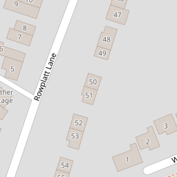


Leaflet © OpenStreetMap contributors
The heatmap indicates the level of crime in the area. The color of the heatmap indicates the crime severity and recency.
Metrics Year-on-Year
- Average area value
- 383,000.00 £Increased by 12.20 %
- Average area rental value
- 764.00 £/moDecreased by 19.32 %
- Est rental Yield
- 2.39 %Decreased by 28.23 %
- Crime Rate
- 35.00 %Unchanged by 0.00 %
from 341,360.00 £
from 947.00 £/mo
from 3.33 %
from 35.00 %
Nearby Schools
| Name | Type | Ofsted | Distance |
|---|---|---|---|
| Felbridge Primary School | Community School | Good | 0.82 KM |
| Imberhorne School | Community School | Good | 2.13 KM |
| Crawley Down Village Cofe | Voluntary Controlled School | Good | 2.85 KM |
| Halsford Park Primary School | Academy Converter | Good | 3.05 KM |
| St Peter'S Catholic Primary School | Voluntary Aided School | Good | 3.10 KM |
Images
Nearby Streets
| Name | Average Price | Average Sqft | Distance |
|---|---|---|---|
| Mortain Road | £ 425,000 | 0 | 0.00 KM |
| Birch Grove | £ 700,000 | 0 | 0.00 KM |
| Birches View | £ 925,000 | 0 | 0.00 KM |
| Whittington College | £ 0 | 0 | 0.00 KM |
| Wards Farm | £ 0 | 0 | 0.00 KM |
Nearby Transport
| Name | NLC | TLC | Distance |
|---|---|---|---|
| East Grinstead | 5486 | EGR | 4.16 KM |
| Dormans | 5413 | DMS | 5.72 KM |
| Lingfield | 5369 | LFD | 6.57 KM |
| Godstone | 5474 | GDN | 8.80 KM |
Nearby Listings
| Address | Price | Type | Score | Distance |
|---|---|---|---|---|
| The Waldrons, Rowplatt Lane, Felbridge, RH19 | £ 535,000 | BUY | 6 / 10 | 0.01 KM |
| The Waldrons, Rowplatt Lane, Felbridge, RH19 | £ 665,000 | BUY | 7 / 10 | 0.01 KM |
| Plot 6 - The Waldrons, Felbridge, Surrey, RH19 | £ 665,000 | BUY | 7 / 10 | 0.01 KM |
| Plot 2 - The Waldrons, Felbridge, Surrey, RH19 | £ 670,000 | BUY | 7 / 10 | 0.01 KM |
| Plot 3 - The Waldrons, Felbridge, Surrey, RH19 | £ 699,950 | BUY | 7 / 10 | 0.01 KM |
Nearby Properties
| Address | Price | Distance |
|---|---|---|
| 24a Rowplatt Lane | £ 360,000 | 0.00 KM |
| 12 Rowplatt Lane | £ 460,000 | 0.00 KM |
| Glentrool 23 Rowplatt Lane | £ 132,000 | 0.00 KM |
| 8 Rowplatt Lane | £ 390,000 | 0.00 KM |
| 27 Rowplatt Lane | £ 320,000 | 0.00 KM |