UN
25 Fish Lane
£ 690,000
Description
We don't have a Description for this property.
- Bedrooms
- 3
- Bathrooms
- 0
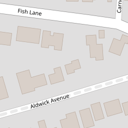

Leaflet © OpenStreetMap contributors
The heatmap indicates the level of crime in the area. The color of the heatmap indicates the crime severity and recency.
Metrics Year-on-Year
- Average area value
- 761,083.00 £Increased by 6.90 %
- Average area rental value
- 2,056.00 £/moDecreased by 3.34 %
- Est rental Yield
- 3.24 %Decreased by 9.75 %
- Crime Rate
- 10.00 %Unchanged by 0.00 %
from 711,963.00 £
from 2,127.00 £/mo
from 3.59 %
from 10.00 %
Nearby Schools
| Name | Type | Ofsted | Distance |
|---|---|---|---|
| Nyewood Cofe Junior School | Voluntary Aided School | Good | 0.98 KM |
| Nyewood Cofe Infant School, Bognor Regis | Voluntary Aided School | Good | 1.04 KM |
| Southway Primary School | Academy Sponsor Led | Requires improvement | 1.65 KM |
| The Regis School | Academy Sponsor Led | Good | 1.71 KM |
| Bognor Children And Family Centre | Children's Centre | 1.97 KM |
Images
Nearby Streets
| Name | Average Price | Average Sqft | Distance |
|---|---|---|---|
| Trotyn Croft | £ 575,000 | 0 | 0.00 KM |
| High Trees | £ 650,000 | 0 | 0.00 KM |
| Elm Grove | £ 0 | 0 | 0.00 KM |
| Waters Edge | £ 0 | 0 | 0.00 KM |
| Grange Court | £ 649,983 | 0 | 0.00 KM |
Nearby Transport
| Name | NLC | TLC | Distance |
|---|---|---|---|
| Bognor Regis | 5253 | BOG | 2.48 KM |
| Barnham | 5252 | BAA | 8.55 KM |
Nearby Listings
| Address | Price | Type | Score | Distance |
|---|---|---|---|---|
| Fish Lane, Aldwick, Bognor Regis, West Sussex, PO21 | £ 850,000 | BUY | 6 / 10 | 0.00 KM |
| Fish Lane, Bognor Regis, West Sussex, PO21 | £ 750,000 | BUY | 7 / 10 | 0.00 KM |
| Aldwick Avenue, Bognor Regis, PO21 | £ 350,000 | BUY | 6 / 10 | 0.09 KM |
| Carnot Close, Aldwick, PO21 | £ 450,000 | BUY | Unknown | 0.10 KM |
| Aldwick Avenue, Aldwick, PO21 | £ 650,000 | BUY | 6 / 10 | 0.10 KM |
Nearby Properties
| Address | Price | Distance |
|---|---|---|
| 16 Fish Lane | £ 163,000 | 0.00 KM |
| 19 Fish Lane | £ 330,000 | 0.00 KM |
| 30 Fish Lane | £ 785,000 | 0.00 KM |
| 40 Fish Lane | £ 345,000 | 0.00 KM |
| 20 Fish Lane | £ 280,000 | 0.00 KM |