UN
4 Ferring Close
£ 154,000
Description
We don't have a Description for this property.
- Bedrooms
- 1
- Bathrooms
- 0
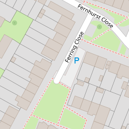

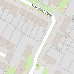

Leaflet © OpenStreetMap contributors
The heatmap indicates the level of crime in the area. The color of the heatmap indicates the crime severity and recency.
Metrics Year-on-Year
- Average area value
- 345,589.00 £Decreased by 8.67 %
- Average area rental value
- 1,555.00 £/moIncreased by 8.14 %
- Est rental Yield
- 5.40 %Increased by 18.42 %
- Crime Rate
- 8.00 %Unchanged by 0.00 %
from 378,388.00 £
from 1,438.00 £/mo
from 4.56 %
from 8.00 %
Nearby Schools
| Name | Type | Ofsted | Distance |
|---|---|---|---|
| St Margaret'S Cofe Primary School | Voluntary Aided School | Requires improvement | 0.14 KM |
| Manor Green Primary School | Community Special School | Outstanding | 0.33 KM |
| Our Lady Queen Of Heaven Catholic Primary School, Crawley | Voluntary Aided School | Good | 0.57 KM |
| Ifield Community College | Community School | Good | 0.63 KM |
| Langley Green And Ifield Children & Family Centre | Children's Centre | 0.88 KM |
Images
Nearby Streets
| Name | Average Price | Average Sqft | Distance |
|---|---|---|---|
| The Dingle | £ 200,000 | 0 | 0.00 KM |
| Chiltern Close | £ 330,000 | 0 | 0.00 KM |
| Fir Tree Close | £ 0 | 0 | 0.00 KM |
| Rudgwick Road | £ 0 | 0 | 0.00 KM |
| Garden Walk | £ 149,750 | 0 | 0.00 KM |
Nearby Transport
| Name | NLC | TLC | Distance |
|---|---|---|---|
| Ifield | 5495 | IFI | 1.16 KM |
| Crawley | 5484 | CRW | 2.54 KM |
| Three Bridges | 5491 | TBD | 5.12 KM |
| Gatwick Airport | 5416 | GTW | 6.33 KM |
| Faygate | 5493 | FGT | 6.86 KM |
Nearby Listings
| Address | Price | Type | Score | Distance |
|---|---|---|---|---|
| Framfield Close, Crawley, RH11 | £ 185,000 | BUY | 5 / 10 | 0.05 KM |
| Ferring Close, Crawley, RH11 | £ 220,000 | BUY | 6 / 10 | 0.07 KM |
| Framfield Close, Crawley, RH11 | £ 180,000 | BUY | Unknown | 0.17 KM |
| Millfield Court, Ifield, Crawley, West Sussex, RH11 | £ 150,000 | BUY | 5 / 10 | 0.18 KM |
| Ifield Drive, Crawley, West Sussex. RH11 0HD | £ 230,000 | BUY | 6 / 10 | 0.19 KM |
Nearby Properties
| Address | Price | Distance |
|---|---|---|
| 28 Ferring Close | £ 206,500 | 0.00 KM |
| 15 Ferring Close | £ 308,000 | 0.00 KM |
| 12 Ferring Close | £ 165,000 | 0.00 KM |
| 7 Ferring Close | £ 156,950 | 0.00 KM |
| 17 Ferring Close | £ 298,000 | 0.00 KM |