UN
82 Cunningham Road
£ 185,000
Description
We don't have a Description for this property.
- Bedrooms
- 3
- Bathrooms
- 0
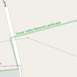

Leaflet © OpenStreetMap contributors
The heatmap indicates the level of crime in the area. The color of the heatmap indicates the crime severity and recency.
Metrics Year-on-Year
- Average area value
- 250,969.00 £Increased by 12.60 %
- Average area rental value
- 950.00 £/moIncreased by 2.26 %
- Est rental Yield
- 4.54 %Decreased by 9.20 %
- Crime Rate
- 19.00 %Unchanged by 0.00 %
from 222,882.00 £
from 929.00 £/mo
from 5.00 %
from 19.00 %
Nearby Schools
| Name | Type | Ofsted | Distance |
|---|---|---|---|
| Mary Dean'S Cofe Primary School | Voluntary Controlled School | Good | 0.48 KM |
| Woodfield Primary School | Academy Converter | Good | 1.72 KM |
| St Peter'S Rc Primary School | Academy Converter | Good | 1.78 KM |
| Whitleigh Children'S Centre | Children's Centre | 1.91 KM | |
| Woodlands School | Foundation Special School | Good | 2.13 KM |
Images
Nearby Streets
| Name | Average Price | Average Sqft | Distance |
|---|---|---|---|
| Allern Lane | £ 290,000 | 0 | 0.00 KM |
| Porsham Lane | £ 0 | 0 | 0.00 KM |
| Magnus Close | £ 0 | 0 | 0.00 KM |
| Trowbridge Close | £ 105,000 | 0 | 0.00 KM |
Nearby Transport
| Name | NLC | TLC | Distance |
|---|---|---|---|
| Bere Ferrers | 3550 | BFE | 3.74 KM |
| St Budeaux Victoria Road | 3592 | SBV | 5.50 KM |
| St Budeaux Ferry Road | 3590 | SBF | 5.50 KM |
| Keyham | 3571 | KEY | 6.01 KM |
| Plymouth | 3580 | PLY | 6.53 KM |
Nearby Listings
| Address | Price | Type | Score | Distance |
|---|---|---|---|---|
| Cunningham Road, Tamerton Foliot, Plymouth, Devon, PL5 | £ 170,000 | BUY | 5 / 10 | 0.02 KM |
| Cunningham Road, Tamerton Foliot, Plymouth | £ 190,000 | BUY | 7 / 10 | 0.09 KM |
| Cunningham Road, Plymouth Beautifully Presented Three-Bedroom End-Terrace Home in Sought-After Tamerton Foliot | £ 210,000 | BUY | Unknown | 0.09 KM |
| Cunningham Road, Tamerton Foliot, Plymouth, PL5 4PS | £ 165,000 | BUY | 5 / 10 | 0.09 KM |
| Halter Close, Tamerton Foliot, Plymouth | £ 280,000 | BUY | 7 / 10 | 0.19 KM |
Nearby Properties
| Address | Price | Distance |
|---|---|---|
| 97 Cunningham Road | £ 120,000 | 0.00 KM |
| 77 Cunningham Road | £ 51,574 | 0.00 KM |
| 71 Cunningham Road | £ 129,000 | 0.00 KM |
| 65 Cunningham Road | £ 158,000 | 0.00 KM |
| 79 Cunningham Road | £ 149,000 | 0.00 KM |