UN
4 Broadway
£ 122,000
Description
We don't have a Description for this property.
- Bedrooms
- 2
- Bathrooms
- 0
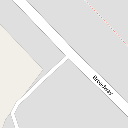


Leaflet © OpenStreetMap contributors
The heatmap indicates the level of crime in the area. The color of the heatmap indicates the crime severity and recency.
Metrics Year-on-Year
- Average area value
- 433,750.00 £Increased by 2.36 %
- Average area rental value
- 1,164.00 £/moIncreased by 12.68 %
- Est rental Yield
- 3.22 %Increased by 9.90 %
- Crime Rate
- 35.00 %Unchanged by 0.00 %
from 423,750.00 £
from 1,033.00 £/mo
from 2.93 %
from 35.00 %
Nearby Schools
| Name | Type | Ofsted | Distance |
|---|---|---|---|
| Merriott First School | Community School | Good | 0.50 KM |
| Crewkerne Building | Children's Centre Linked Site | 2.27 KM | |
| Ashlands Church Of England First School | Voluntary Controlled School | Good | 2.27 KM |
| Wadham School | Voluntary Controlled School | Good | 2.38 KM |
| St Bartholomew'S Church Of England First School | Voluntary Controlled School | Good | 3.25 KM |
Images
Nearby Streets
| Name | Average Price | Average Sqft | Distance |
|---|---|---|---|
| Old Bell Close | £ 0 | 0 | 0.00 KM |
| Turnpike House | £ 0 | 0 | 0.00 KM |
| The Close | £ 270,000 | 0 | 0.00 KM |
| Old Farm Close | £ 0 | 0 | 0.00 KM |
| Manor Drive | £ 0 | 0 | 0.00 KM |
Nearby Transport
| Name | NLC | TLC | Distance |
|---|---|---|---|
| Crewkerne | 5832 | CKN | 4.19 KM |
Nearby Listings
| Address | Price | Type | Score | Distance |
|---|---|---|---|---|
| Orchard Drive, Merriott, Somerset, TA16 | £ 350,000 | BUY | Unknown | 0.12 KM |
| Orchard Drive, Merriott | £ 325,000 | BUY | 7 / 10 | 0.12 KM |
| Merriott, TA16 | £ 250,000 | BUY | 6 / 10 | 0.15 KM |
| 7 Knapp, Merriott | £ 225,000 | BUY | 5 / 10 | 0.20 KM |
| Moorlands Road, Merriott | £ 650,000 | BUY | 6 / 10 | 0.22 KM |
Nearby Properties
| Address | Price | Distance |
|---|---|---|
| 27 Broadway | £ 343,000 | 0.00 KM |
| 46 Broadway | £ 285,000 | 0.00 KM |
| 8 Broadway | £ 200,000 | 0.00 KM |
| 48 Broadway | £ 146,000 | 0.00 KM |
| 16 Broadway | £ 215,000 | 0.00 KM |