UN
20 Derby Road
£ 130,000
Description
We don't have a Description for this property.
- Bedrooms
- 3
- Bathrooms
- 0
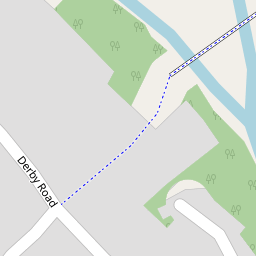

Leaflet © OpenStreetMap contributors
The heatmap indicates the level of crime in the area. The color of the heatmap indicates the crime severity and recency.
Metrics Year-on-Year
- Average area value
- 267,500.00 £Decreased by 0.99 %
- Average area rental value
- 1,107.00 £/moDecreased by 6.11 %
- Est rental Yield
- 4.97 %Decreased by 5.15 %
- Crime Rate
- 48.00 %Unchanged by 0.00 %
from 270,182.00 £
from 1,179.00 £/mo
from 5.24 %
from 48.00 %
Nearby Schools
| Name | Type | Ofsted | Distance |
|---|---|---|---|
| Ysgol Estyn C.P. | Welsh Establishment | 0.71 KM | |
| Castell Alun High School | Welsh Establishment | 0.94 KM | |
| Abermorddu C.P. School | Welsh Establishment | 1.17 KM | |
| St Mary'S Aided Primary School | Welsh Establishment | 4.00 KM | |
| Ysgol Heulfan | Welsh Establishment | 4.08 KM |
Images
Nearby Streets
| Name | Average Price | Average Sqft | Distance |
|---|---|---|---|
| Bryn-Yorkin Road | £ 650,000 | 0 | 0.00 KM |
| Queensway | £ 0 | 0 | 0.00 KM |
| Pughs Yard | £ 249,950 | 0 | 0.00 KM |
| Crossways | £ 0 | 0 | 0.00 KM |
| Tudor Court | £ 0 | 0 | 0.00 KM |
Nearby Transport
| Name | NLC | TLC | Distance |
|---|---|---|---|
| Caergwrle | 2536 | CGW | 0.69 KM |
| Hope (Flintshire) | 2432 | HPE | 0.76 KM |
| Cefn-Y-Bedd | 2425 | CYB | 1.56 KM |
| Penyffordd | 2433 | PNF | 4.03 KM |
| Gwersyllt | 4300 | GWE | 4.81 KM |
Nearby Listings
| Address | Price | Type | Score | Distance |
|---|---|---|---|---|
| Caergwrle, Wrexham | £ 185,000 | BUY | 7 / 10 | 0.00 KM |
| Derby Road, Caergwrle | £ 165,000 | BUY | 7 / 10 | 0.00 KM |
| Alyn Crescent, Caergwrle, Wrexham, Flintshire, LL12 | £ 200,000 | BUY | 5 / 10 | 0.17 KM |
| Derby Road, LL12 9AE | £ 235,000 | BUY | Unknown | 0.23 KM |
| Castle Street, Caergwrle, Wrexham, Flintshire, LL12 | £ 225,000 | BUY | 4 / 10 | 0.24 KM |
Nearby Properties
| Address | Price | Distance |
|---|---|---|
| 39 Derby Road | £ 145,000 | 0.00 KM |
| 20 Derby Road | £ 130,000 | 0.00 KM |
| 31 Derby Road | £ 222,000 | 0.00 KM |
| 2 Derby Road | £ 129,400 | 0.00 KM |
| 2a Derby Road | £ 153,500 | 0.00 KM |