DE
Bryony Road, London
By Dexters
£ 553
Dexters says ..
No summary available.
- Bedrooms
- 1
- Bathrooms
- 1
The heatmap indicates the level of crime in the area. The color of the heatmap indicates the crime severity and recency.
Metrics Year-on-Year
- Average area value
- 603,333.00 £Decreased by 25.74 %
- Average area rental value
- 1,627.00 £/moDecreased by 25.78 %
- Est rental Yield
- 3.24 %Unchanged by 0.00 %
- Crime Rate
- 3.00 %Unchanged by 0.00 %
from 812,454.00 £
from 2,192.00 £/mo
from 3.24 %
from 3.00 %
Agent Activity
Dexters created the listing.
Nearby Schools
| Name | Type | Ofsted | Distance |
|---|---|---|---|
| Wormholt Park Primary School | Community School | Good | 0.06 KM |
| Phoenix Academy | Academy Sponsor Led | Good | 0.25 KM |
| Ark Conway Primary Academy | Free Schools | Outstanding | 0.47 KM |
| Queensmill School | Academy Special Converter | 0.61 KM | |
| Q+ | Special Post 16 Institution | 0.61 KM |
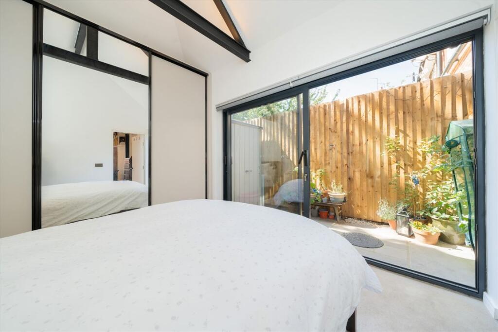
Images


Nearby Streets
| Name | Average Price | Average Sqft | Distance |
|---|---|---|---|
| Gravesend Road | £ 0 | 0 | 0.00 KM |
| Malabar Way | £ 0 | 0 | 0.00 KM |
| Askham Court | £ 900,000 | 0 | 0.00 KM |
| Shabana Court | £ 0 | 0 | 0.00 KM |
| Westway | £ 0 | 0 | 0.00 KM |
Nearby Transport
| Name | NLC | TLC | Distance |
|---|---|---|---|
| Willesden Junction | 1457 | WIJ | 2.45 KM |
| Shepherd'S Bush | 9587 | SPB | 2.45 KM |
| Kensal Green | 1447 | KNL | 2.65 KM |
| Acton Central | 1404 | ACC | 2.66 KM |
| Acton Main Line | 3000 | AML | 3.14 KM |
Nearby Listings
| Address | Price | Type | Score | Distance |
|---|---|---|---|---|
| Dunraven Road, London, W12 | £ 1,695 | RENT | Unknown | 0.18 KM |
| Dunraven Road, London, W12 | £ 1,450 | RENT | Unknown | 0.18 KM |
| Galloway Road, Shepherd's Bush, London, W12 | £ 3,000 | RENT | Unknown | 0.19 KM |
| Galloway Road Shepherds Bush London, W12 | £ 3,600 | RENT | Unknown | 0.20 KM |
| Bryony Road, Shepherds Bush | £ 646 | RENT | Unknown | 0.23 KM |
Nearby Properties
| Address | Price | Distance |
|---|---|---|
| 6 Pansy Gardens | £ 430,000 | 0.10 KM |
| 7 Pansy Gardens | £ 515,000 | 0.10 KM |
| 4 Pansy Gardens | £ 760,000 | 0.10 KM |
| 46 The Curve | £ 700,000 | 0.13 KM |
| 35 The Curve | £ 277,000 | 0.14 KM |