WH
Walkley Road, Sheffield, S6
By Whitehornes
£ 1,400
Whitehornes says ..
Not to be missed!
- Bedrooms
- 3
- Bathrooms
- 1
The heatmap indicates the level of crime in the area. The color of the heatmap indicates the crime severity and recency.
Metrics Year-on-Year
- Average area value
- 227,500.00 £Decreased by 1.97 %
- Average area rental value
- 979.00 £/moIncreased by 16.83 %
- Est rental Yield
- 5.16 %Increased by 19.17 %
- Crime Rate
- 4.00 %Unchanged by 0.00 %
from 232,070.00 £
from 838.00 £/mo
from 4.33 %
from 4.00 %
Agent Activity
Whitehornes created the listing.
Nearby Schools
| Name | Type | Ofsted | Distance |
|---|---|---|---|
| Walkley Primary School | Community School | Good | 0.12 KM |
| St Mary'S Church Of England Primary School | Academy Sponsor Led | Good | 0.26 KM |
| Primrose Children'S Centre | Children's Centre | 0.52 KM | |
| Sacred Heart School, A Catholic Voluntary Academy | Academy Converter | Good | 0.76 KM |
| Rivelin Primary School | Community School | Good | 1.04 KM |
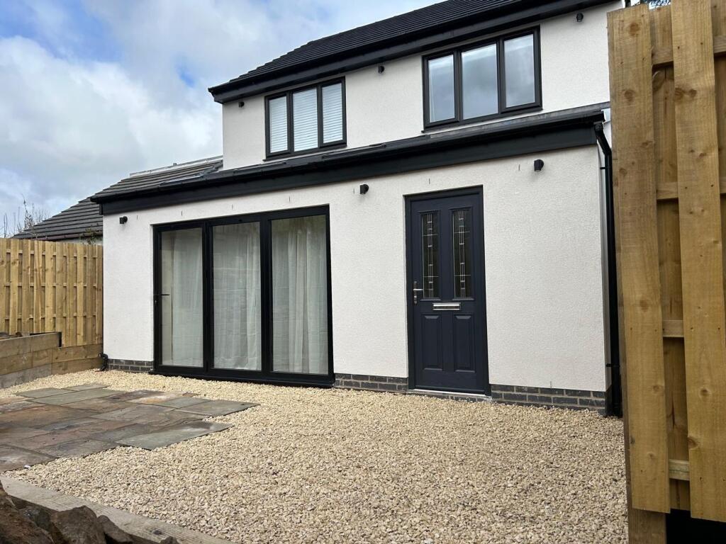
Images


Nearby Streets
| Name | Average Price | Average Sqft | Distance |
|---|---|---|---|
| Victor Street | £ 0 | 0 | 0.00 KM |
| Capel Street | £ 0 | 0 | 0.00 KM |
| Fox Walk | £ 175,000 | 0 | 0.00 KM |
| Learoyd Way | £ 0 | 0 | 0.00 KM |
| Gresham Road | £ 200,000 | 0 | 0.00 KM |
Nearby Transport
| Name | NLC | TLC | Distance |
|---|---|---|---|
| Sheffield | 6691 | SHF | 4.18 KM |
| Dore And Totley | 6690 | DOR | 7.83 KM |
| Chapeltown (South Yorkshire) | 6664 | CLN | 8.15 KM |
| Darnall | 6729 | DAN | 9.28 KM |
| Meadowhall | 6663 | MHS | 9.50 KM |
Nearby Listings
| Address | Price | Type | Score | Distance |
|---|---|---|---|---|
| King James Street, Walkley, Sheffield, S6 2SU | £ 850 | RENT | Unknown | 0.09 KM |
| Cundy Street, S6 2WN | £ 1,300 | RENT | Unknown | 0.23 KM |
| 54 Whitehouse Road, Sheffield | £ 950 | RENT | Unknown | 0.24 KM |
| Cundy Street, Sheffield | £ 1,500 | RENT | Unknown | 0.24 KM |
| Burgoyne Road, Sheffield | £ 1,200 | RENT | Unknown | 0.27 KM |
Nearby Properties
| Address | Price | Distance |
|---|---|---|
| 42 Industry Street | £ 45,000 | 0.13 KM |
| 38 Industry Street | £ 195,000 | 0.13 KM |
| 24 Industry Street | £ 137,000 | 0.13 KM |
| 66 Industry Street | £ 153,000 | 0.13 KM |
| 28 Industry Street | £ 170,500 | 0.13 KM |