MA
Fog Lane, Manchester, M19 1SS
By Manchester Hive
£ 600
Manchester Hive says ..
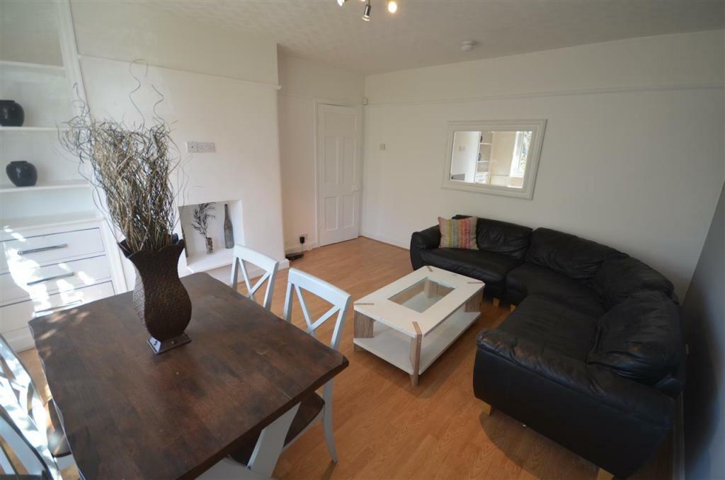
Make this large room in a stylish modern HOUSE SHARE in a great location in Burnage your next home. All bills are included.
- Bedrooms
- 1
- Bathrooms
- 1
The heatmap indicates the level of crime in the area. The color of the heatmap indicates the crime severity and recency.
Metrics Year-on-Year
- Average area value
- 533,583.00 £Increased by 11.40 %
- Average area rental value
- 1,591.00 £/moIncreased by 15.54 %
- Est rental Yield
- 3.58 %Increased by 3.77 %
- Crime Rate
- 185.00 %Unchanged by 0.00 %
from 479,000.00 £
from 1,377.00 £/mo
from 3.45 %
from 185.00 %
Agent Activity
Manchester Hive created the listing.
Nearby Schools
| Name | Type | Ofsted | Distance |
|---|---|---|---|
| The Barlow Rc High School And Specialist Science College | Voluntary Aided School | Good | 0.85 KM |
| St Catherine'S Rc Primary School | Voluntary Aided School | Outstanding | 1.00 KM |
| Ladybarn Primary School | Academy Converter | 1.06 KM | |
| St Cuthbert'S Rc Primary School | Voluntary Aided School | Good | 1.25 KM |
| Burnage Academy For Boys | Academy Converter | Outstanding | 1.29 KM |
Images


Nearby Streets
| Name | Average Price | Average Sqft | Distance |
|---|---|---|---|
| Albury Drive | £ 0 | 0 | 0.00 KM |
| Swinly Crescent | £ 0 | 0 | 0.00 KM |
| Adria Avenue | £ 250,000 | 0 | 0.00 KM |
| Parrs Wood View | £ 0 | 0 | 0.00 KM |
| Mere Avenue | £ 0 | 0 | 0.00 KM |
Nearby Transport
| Name | NLC | TLC | Distance |
|---|---|---|---|
| Burnage | 2945 | BNA | 0.09 KM |
| Mauldeth Road | 2867 | MAU | 1.47 KM |
| East Didsbury | 2949 | EDY | 1.53 KM |
| Levenshulme | 2862 | LVM | 3.55 KM |
| Gatley | 2953 | GTY | 3.62 KM |
Nearby Listings
| Address | Price | Type | Score | Distance |
|---|---|---|---|---|
| Fog Lane, Merlin House, M19 | £ 1,050 | RENT | Unknown | 0.04 KM |
| Merlin House, Manchester, M19 | £ 1,200 | RENT | Unknown | 0.04 KM |
| Merlin House, Manchester, M19 | £ 1,100 | RENT | Unknown | 0.04 KM |
| Shearwater House, Fog Lane, Burnage | £ 1,250 | RENT | Unknown | 0.05 KM |
| Hurstbank Avenue, Burnage, Manchester, M19 | £ 1,500 | RENT | Unknown | 0.09 KM |
Nearby Properties
| Address | Price | Distance |
|---|---|---|
| 201 Fog Lane | £ 161,000 | 0.01 KM |
| 211 Fog Lane | £ 260,000 | 0.01 KM |
| 207 Fog Lane | £ 46,000 | 0.07 KM |
| 276a Fog Lane | £ 188,100 | 0.13 KM |
| 264 Fog Lane | £ 250,000 | 0.13 KM |