hammondlee says ..
Situated in a sought-after location, this semi-detached home provides a fantastic opportunity to create your ideal living space. With a spacious lounge/diner, modern kitchen and 3 good-sized bedrooms, it provides a great layout for family living. The property also features a south-west facing rea...
Property Oracle says ..
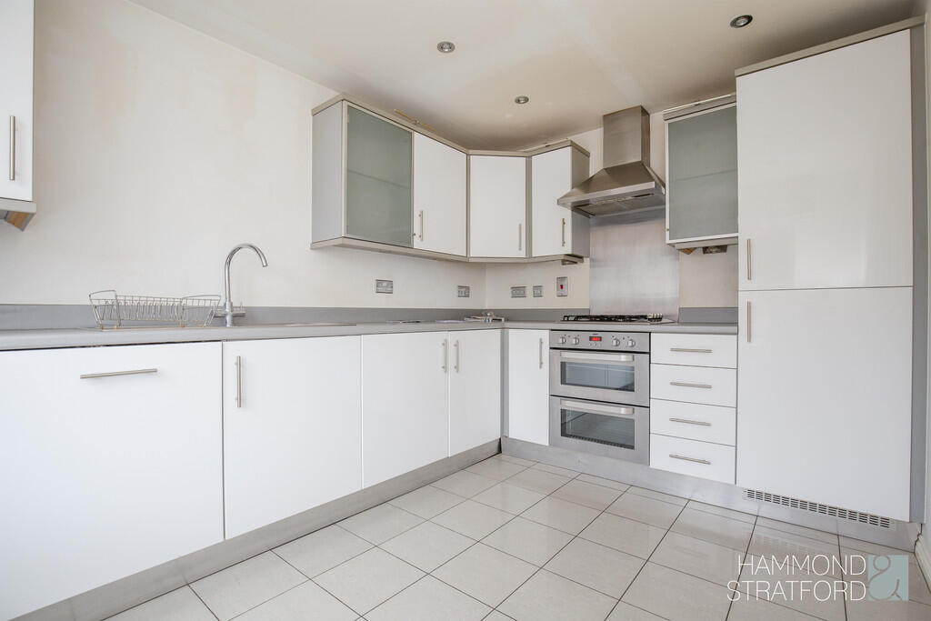
The property is a 3-bedroom, 2-bathroom house with a total area of 861.11 sqft and is listed at £260,000. The property benefits from having a garden. Attleborough is a town in Breckland, Norfolk, with nearby schools such as Rosecroft Primary School and Attleborough Academy, both rated as “Good” by Ofsted. The property is also conveniently located near Attleborough train station, providing access to Greater Anglia rail services. The property appears to be in reasonable condition based on the provided images. While the interior is largely unfurnished, the visible fixtures and fittings appear to be in good working order and relatively modern. There is no obvious evidence of significant damage or disrepair. The average house price in the area is £348,202, significantly higher than the listed price of this property. However, the average house size is 1,118 sqft, considerably larger than the 861.11 sqft of this property. The average price per sqft in the area is £311.00. Considering the smaller size of the property and its seemingly good condition, the listed price of £260,000 may represent reasonable value for money, particularly when compared to similar properties in the area. However, the lack of information on the plot size and the condition of the property makes it difficult to make a definitive statement about the price.
Therefore, we give this property 7 / 10. *Disclaimer: This is our option and does constitute a recommendation or financial advice. Do your own research. *
- Price
- 7
- Condition
- 7
- Location
- 8
- Land
- 6
- Bedrooms
- 3
- Bathrooms
- 2
- Sqft (est)
- 861.11
The heatmap indicates the level of crime in the area. The color of the heatmap indicates the crime severity and recency.
Metrics Year-on-Year
- Average area value
- 284,479.00 £Decreased by 9.41 %
- Est sale value
- 204,944.18 £Decreased by 2.06 %
- Average area rental value
- 1,398.00 £/moIncreased by 36.12 %
- Est letting value
- 861.11 £/mo
- Est rental Yield
- 5.90 %Increased by 50.51 %
- Crime Rate
- 9.00 %Unchanged by 0.00 %
Agent Activity
hammondlee created the listing.
Nearby Schools
| Name | Type | Ofsted | Distance |
|---|---|---|---|
| Rosecroft Primary School | Community School | Good | 0.82 KM |
| Attleborough Area Children'S Centre | Children's Centre | 1.75 KM | |
| Attleborough Academy | Academy Converter | Good | 1.89 KM |
| Attleborough Primary School | Community School | Good | 2.23 KM |
| Great Ellingham Primary School | Community School | Good | 4.11 KM |
Images


Nearby Streets
| Name | Average Price | Average Sqft | Distance |
|---|---|---|---|
| Springfields | £ 290,000 | 0 | 0.00 KM |
| Violet Close | £ 270,000 | 0 | 0.00 KM |
| Cowslip Meadow | £ 0 | 0 | 0.00 KM |
| Carnation Close | £ 0 | 0 | 0.00 KM |
| Whitehorse Lane | £ 0 | 0 | 0.00 KM |
Nearby Transport
| Name | NLC | TLC | Distance |
|---|---|---|---|
| Attleborough | 7367 | ATL | 2.17 KM |
| Eccles Road | 7370 | ECS | 6.02 KM |
| Spooner Row | 7379 | SPN | 9.55 KM |
Nearby Listings
| Address | Price | Type | Score | Distance |
|---|---|---|---|---|
| Blackthorn Road, Attleborough | £ 250,000 | BUY | 7 / 10 | 0.00 KM |
| Sorrel Drive, Attleborough, Norfolk, NR17 | £ 250,000 | BUY | 7 / 10 | 0.05 KM |
| Sorrel Drive, Attleborough | £ 325,000 | BUY | Unknown | 0.06 KM |
| Sorrel Drive, Attleborough NR17 | £ 220,000 | BUY | 6 / 10 | 0.08 KM |
| Campion Way, Attleborough, Norfolk, NR17 | £ 240,000 | BUY | 7 / 10 | 0.10 KM |
Nearby Properties
| Address | Price | Distance |
|---|---|---|
| 34 Sorrel Drive | £ 146,950 | 0.08 KM |
| 17 Sorrel Drive | £ 48,000 | 0.08 KM |
| 16 Sorrel Drive | £ 195,000 | 0.08 KM |
| 37 Sorrel Drive | £ 200,000 | 0.08 KM |
| 11 Sorrel Drive | £ 251,737 | 0.08 KM |