ST
Dartmouth
By Stags
£ 1,000
Stags says ..
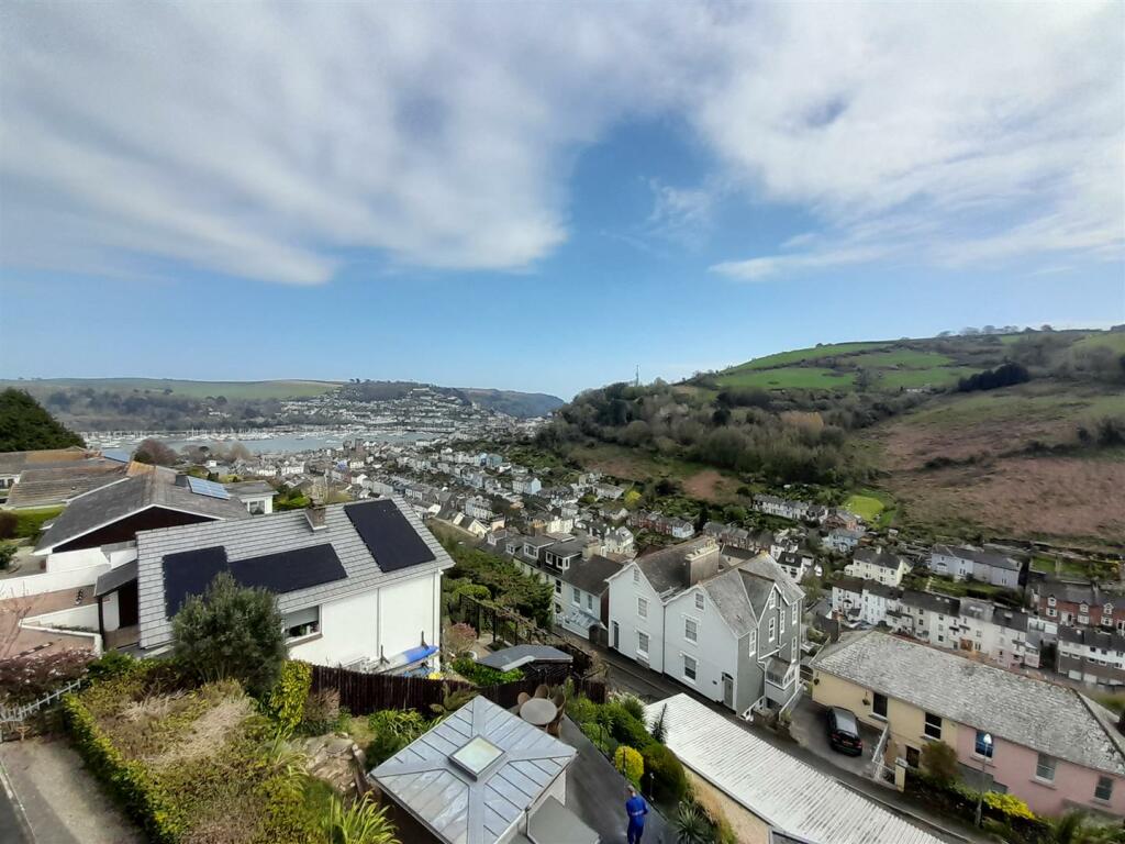
Spacious unfurnished or part furnished top floor apartment with outstanding views of the River Dart,
- Bedrooms
- 4
- Bathrooms
- 2
The heatmap indicates the level of crime in the area. The color of the heatmap indicates the crime severity and recency.
Metrics Year-on-Year
- Average area value
- 831,571.00 £Increased by 59.88 %
- Average area rental value
- 1,217.00 £/moDecreased by 4.92 %
- Est rental Yield
- 1.76 %Decreased by 40.34 %
- Crime Rate
- 23.00 %Unchanged by 0.00 %
from 520,136.00 £
from 1,280.00 £/mo
from 2.95 %
from 23.00 %
Agent Activity
Stags created the listing.
Nearby Schools
| Name | Type | Ofsted | Distance |
|---|---|---|---|
| Dartmouth Academy | Academy Sponsor Led | Good | 1.01 KM |
| Dartmouth & District Children'S Centre | Children's Centre | 1.08 KM | |
| St John The Baptist Roman Catholic Primary School, Dartmouth | Academy Converter | Good | 1.22 KM |
| Kingswear Community Primary School | Academy Converter | Good | 2.00 KM |
| Stoke Fleming Community Primary School | Academy Converter | 3.38 KM |
Images


Nearby Streets
| Name | Average Price | Average Sqft | Distance |
|---|---|---|---|
| Albert Place | £ 575,000 | 0 | 0.00 KM |
| Charles Street | £ 385,000 | 0 | 0.00 KM |
| Cox's Steps | £ 475,000 | 0 | 0.00 KM |
| Chapel Lane | £ 800,000 | 0 | 0.00 KM |
| Undercliff | £ 0 | 0 | 0.00 KM |
Nearby Transport
| Name | NLC | TLC | Distance |
|---|---|---|---|
| Paignton | 3427 | PGN | 9.70 KM |
Nearby Listings
| Address | Price | Type | Score | Distance |
|---|---|---|---|---|
| Manor House, Hillfield, Dartmouth | £ 1,250 | RENT | Unknown | 0.02 KM |
| Victoria Road, Dartmouth | £ 1,850 | RENT | Unknown | 0.04 KM |
| Victoria Road, Dartmouth | £ 875 | RENT | Unknown | 0.06 KM |
| Victoria Road, Dartmouth | £ 1,950 | RENT | Unknown | 0.10 KM |
| Victoria Road, Dartmouth | £ 1,850 | RENT | Unknown | 0.10 KM |
Nearby Properties
| Address | Price | Distance |
|---|---|---|
| 74 Victoria Road | £ 510,000 | 0.03 KM |
| 56 Victoria Road | £ 100,000 | 0.03 KM |
| 80b Victoria Road | £ 155,000 | 0.03 KM |
| 76 Victoria Road | £ 185,000 | 0.03 KM |
| 48 Victoria Road | £ 282,000 | 0.03 KM |