MA
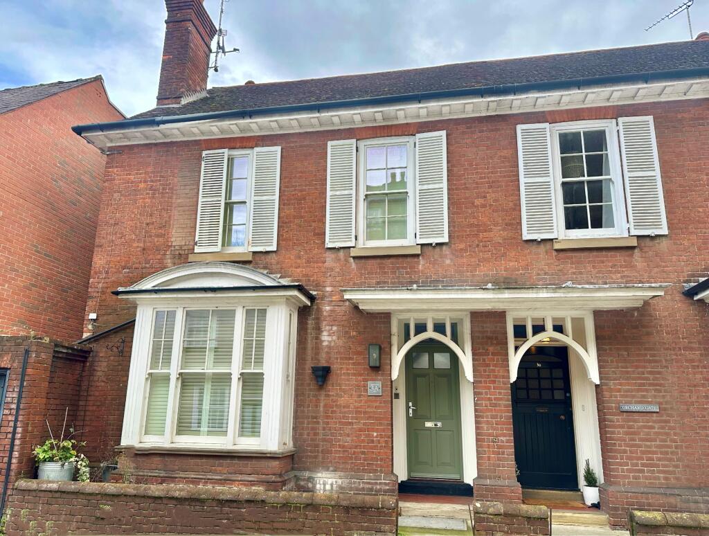
Sparhawk Street, Bury St Edmunds
By Map Letting & Property Management
£ 2,100
Map Letting & Property Management says ..
Stunning Edwardian semi detached house situated within the core of the town.
- Bedrooms
- 3
- Bathrooms
- 0
The heatmap indicates the level of crime in the area. The color of the heatmap indicates the crime severity and recency.
Metrics Year-on-Year
- Average area value
- 388,333.00 £Decreased by 1.98 %
- Average area rental value
- 1,597.00 £/moIncreased by 18.47 %
- Est rental Yield
- 4.93 %Increased by 20.83 %
- Crime Rate
- 2.00 %Unchanged by 0.00 %
from 396,178.00 £
from 1,348.00 £/mo
from 4.08 %
from 2.00 %
Agent Activity
Map Letting & Property Management created the listing.
Nearby Schools
| Name | Type | Ofsted | Distance |
|---|---|---|---|
| Guildhall Feoffment Community Primary School | Community School | Good | 0.27 KM |
| Learning Support, Western Area Education Office | Miscellaneous | 0.37 KM | |
| St Edmund'S Catholic Primary School | Voluntary Aided School | Good | 0.61 KM |
| Hardwick Primary School | Academy Converter | 1.05 KM | |
| Bury Library Children'S Centre | Children's Centre | 1.06 KM |
Images


Nearby Streets
| Name | Average Price | Average Sqft | Distance |
|---|---|---|---|
| Tuns Lane | £ 0 | 0 | 0.00 KM |
| Coppers Close | £ 0 | 0 | 0.00 KM |
| Baker's Lane | £ 0 | 0 | 0.00 KM |
| Redwood Gardens | £ 0 | 0 | 0.00 KM |
| Buttermarket | £ 0 | 0 | 0.00 KM |
Nearby Transport
| Name | NLC | TLC | Distance |
|---|---|---|---|
| Bury St Edmunds | 7008 | BSE | 1.46 KM |
Nearby Listings
| Address | Price | Type | Score | Distance |
|---|---|---|---|---|
| Sparhawk Street, Bury St Edmunds, IP33 | £ 1,300 | RENT | Unknown | 0.00 KM |
| Sparhawk Street (2129), Bury St Edmunds, IP33 | £ 1,450 | RENT | Unknown | 0.00 KM |
| Sparhawk Street (2129), Bury St Edmunds, IP33 | £ 1,450 | RENT | Unknown | 0.00 KM |
| Honey Hill, BURY ST. EDMUNDS | £ 1,600 | RENT | Unknown | 0.08 KM |
| Crown Street, Bury St Edmunds, IP33 | £ 1,300 | RENT | Unknown | 0.18 KM |
Nearby Properties
| Address | Price | Distance |
|---|---|---|
| 3b Sparhawk Street | £ 150,000 | 0.00 KM |
| 3 Sparhawk Street | £ 270,000 | 0.00 KM |
| 6 Sparhawk Street | £ 255,000 | 0.00 KM |
| 3a Sparhawk Street | £ 513,000 | 0.00 KM |
| 7 Sparhawk Street | £ 575,000 | 0.00 KM |