
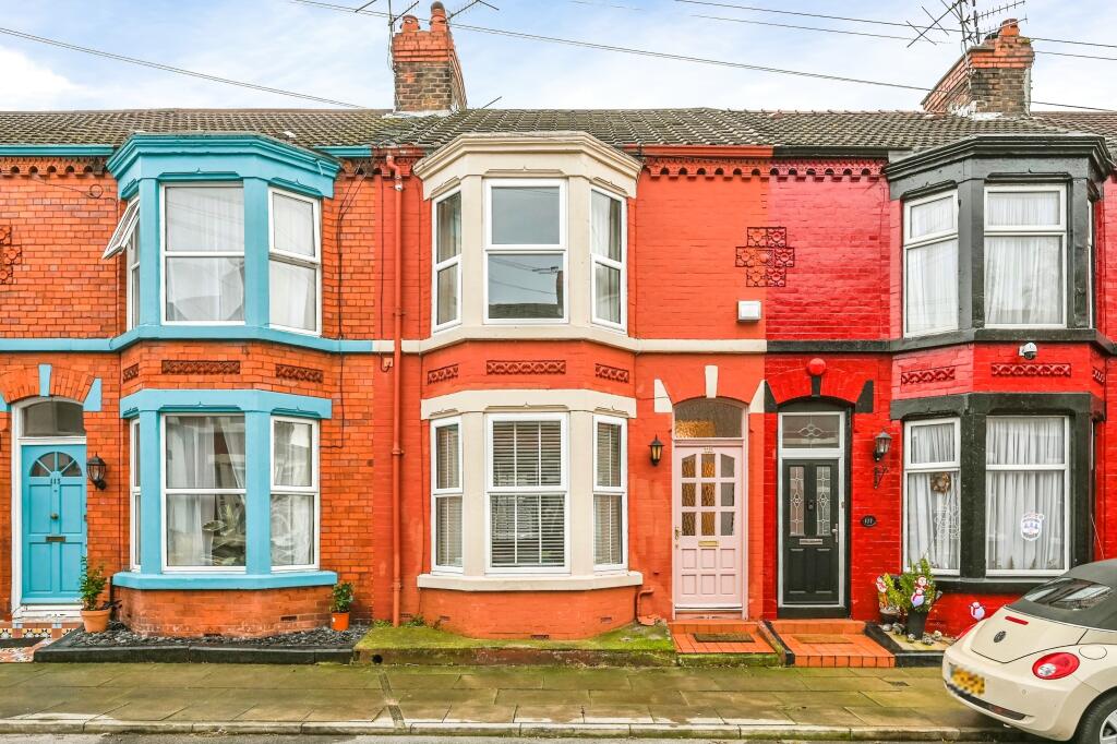
Ashbourne Road, LIVERPOOL, Merseyside, L17
By Entwistle Green
£ 300,000
Reviews
3 out of 5 stars
Entwistle Green says ..
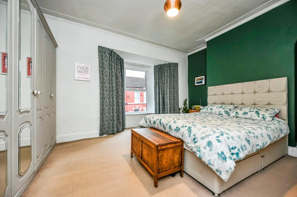
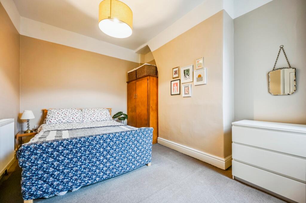
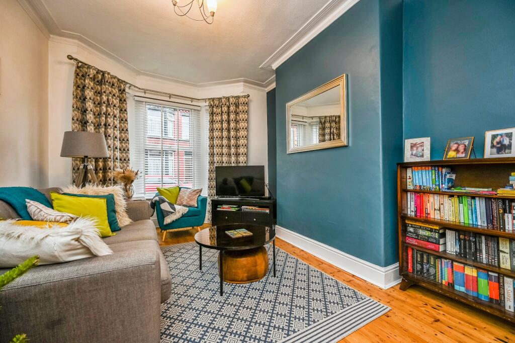
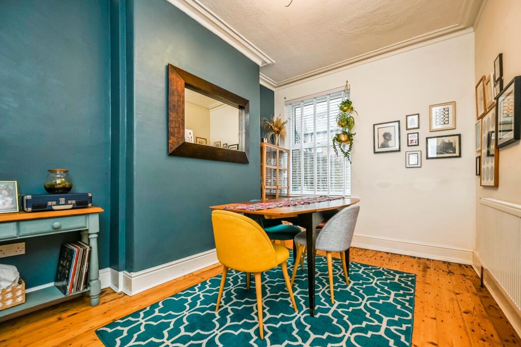
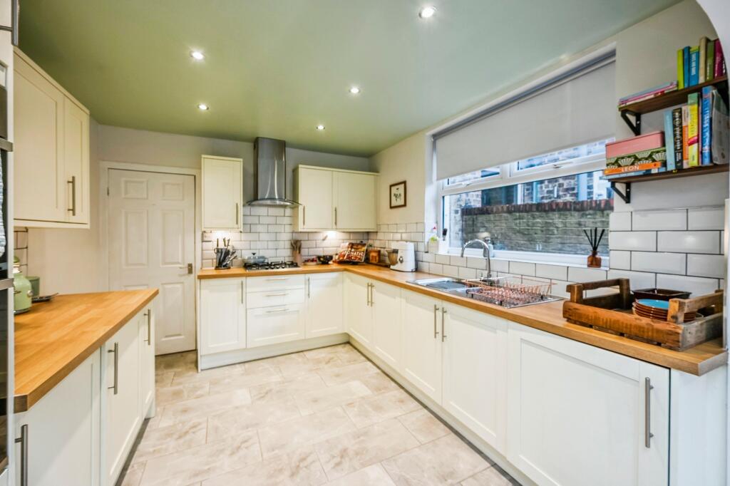
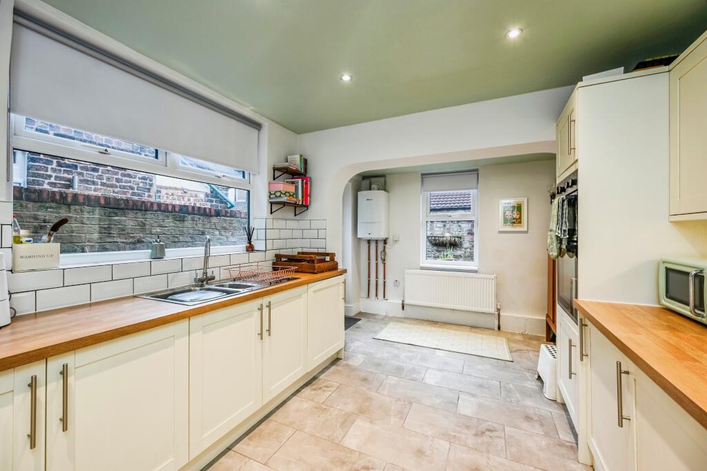
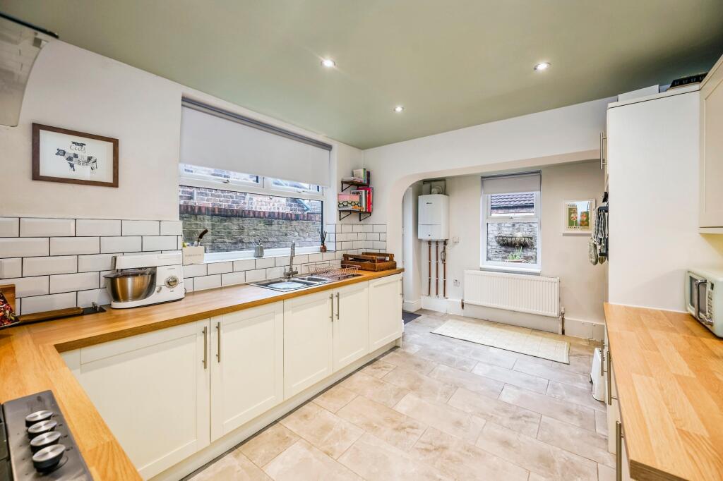
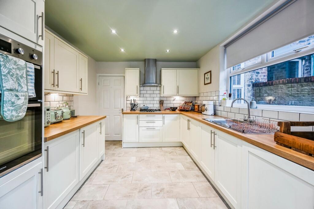
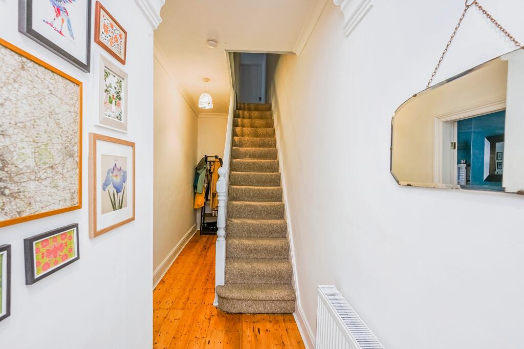
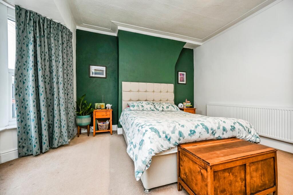
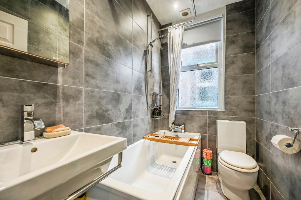
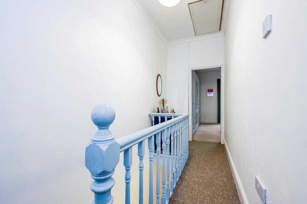
We are delighted to offer this beautifully presented; three-bedroom terrace house located on the sought-after Ashbourne Road in the heart of Liverpool’s L17 postcode. This property is in excellent condition throughout and offers a perfect blend of traditional charm with modern living spaces...
Property Oracle says ..
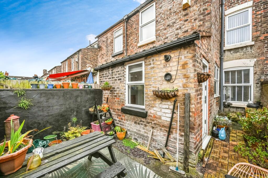
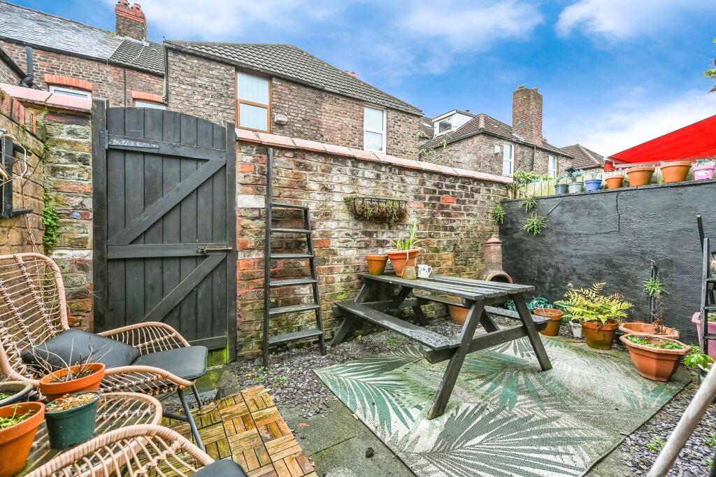
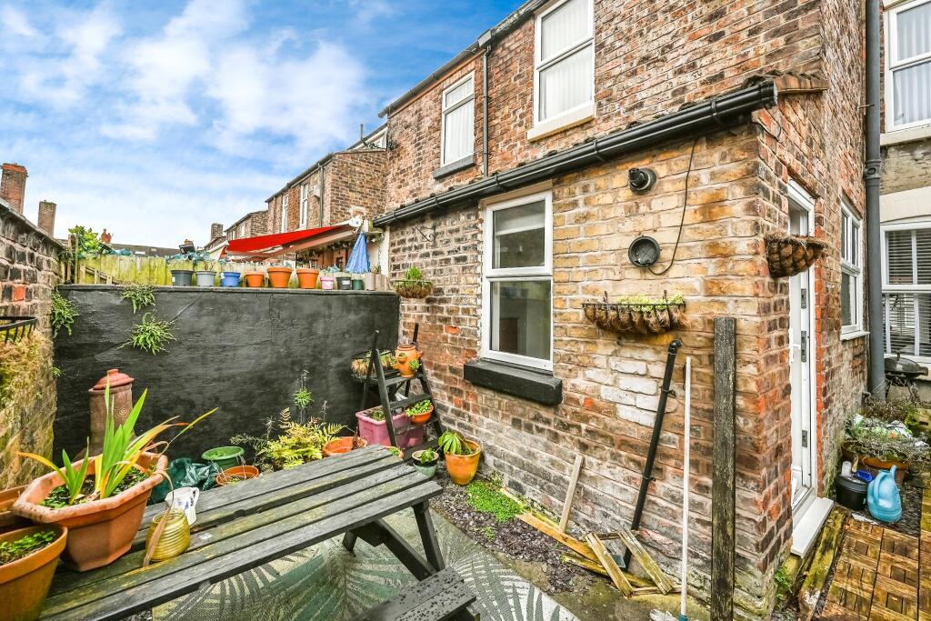
This three-bedroom terraced house located on Ashbourne Road in Liverpool’s L17 postcode presents a well-maintained family home within a desirable residential area. The property’s interior shows a balance of traditional features and modern updates. The kitchen, in particular, has been tastefully modernised. The photographs illustrate a clean and tidy interior throughout. While the property benefits from its proximity to well-regarded schools and relatively convenient access to transportation, the lack of detailed local amenity information requires further clarification to fully assess its location advantages. The external space is limited to a small backyard, typical of this type of property in the area. Considering comparable listings in the vicinity, the property’s asking price appears to be within the average range for properties of similar size and characteristics in the area. However, to conduct a detailed price analysis, more complete information on price per square foot for comparable properties is needed. Overall, it offers a comfortable living environment and could be a suitable family home or investment property. Further investigation into the local market and specifics of the area (amenities, crime rates etc.) is needed for a comprehensive evaluation.
Therefore, we give this property 6 / 10. *Disclaimer: This is our option and does constitute a recommendation or financial advice. Do your own research. *
- Price
- 7
- Condition
- 7
- Location
- 7
- Land
- 3
- Bedrooms
- 3
- Bathrooms
- 1
- Sqft (est)
- 1,102.22


The heatmap indicates the level of crime in the area. The color of the heatmap indicates the crime severity and recency.
Metrics Year-on-Year
- Average area value
- 222,851.00 £Decreased by 12.59 %
- Est sale value
- 156,515.24 £Decreased by 35.45 %
- Average area rental value
- 1,208.00 £/moIncreased by 4.32 %
- Est letting value
- 0.00 £/moDecreased by 100.00 %
- Est rental Yield
- 6.50 %Increased by 19.27 %
- Crime Rate
- 6.00 %Unchanged by 0.00 %
Agent Activity
Entwistle Green created the listing.
Nearby Schools
| Name | Type | Ofsted | Distance |
|---|---|---|---|
| St Charles' Catholic Primary School | Voluntary Aided School | Good | 0.71 KM |
| St Michael-In-The-Hamlet Community Primary School | Community School | Good | 0.91 KM |
| Auckland College | Other Independent School | Outstanding | 1.09 KM |
| Palmerston School | Community Special School | Outstanding | 1.32 KM |
| St Margaret'S Church Of England Academy | Academy Converter | Good | 1.46 KM |
Images

Nearby Streets
| Name | Average Price | Average Sqft | Distance |
|---|---|---|---|
| Amherst Road | £ 130,000 | 0 | 0.00 KM |
| Larkfield Grove | £ 350,000 | 0 | 0.00 KM |
| Eastfield Drive | £ 375,000 | 0 | 0.00 KM |
| St Michaels Road | £ 186,667 | 0 | 0.00 KM |
| Melly Road | £ 390,000 | 0 | 0.00 KM |
Nearby Transport
| Name | NLC | TLC | Distance |
|---|---|---|---|
| St Michaels | 2248 | STM | 1.27 KM |
| Aigburth | 2255 | AIG | 1.83 KM |
| Mossley Hill | 2171 | MSH | 3.00 KM |
| Edge Hill | 2169 | EDG | 3.40 KM |
| Cressington | 2225 | CSG | 3.62 KM |
Nearby Listings
| Address | Price | Type | Score | Distance |
|---|---|---|---|---|
| Ashbourne Road, LIVERPOOL, Merseyside, L17 | £ 300,000 | BUY | 6 / 10 | 0.00 KM |
| Ashbourne Road, Liverpool, L17 | £ 290,000 | BUY | Unknown | 0.03 KM |
| Fulwood Road, Liverpool, L17 | £ 350,000 | BUY | 7 / 10 | 0.08 KM |
| Ampthill Road, Aigburth, Liverpool, L17 | £ 290,000 | BUY | Unknown | 0.09 KM |
| Ancaster Road, Aigburth, L17 | £ 130,000 | BUY | 5 / 10 | 0.11 KM |
Nearby Properties
| Address | Price | Distance |
|---|---|---|
| 137 Ashbourne Road | £ 102,500 | 0.00 KM |
| 81 Ashbourne Road | £ 207,500 | 0.00 KM |
| 89 Ashbourne Road | £ 144,000 | 0.00 KM |
| 115 Ashbourne Road | £ 164,000 | 0.00 KM |
| 139 Ashbourne Road | £ 275,000 | 0.00 KM |