BR
South Street, Rotherham, S62
By BRH
£ 485
BRH says ..
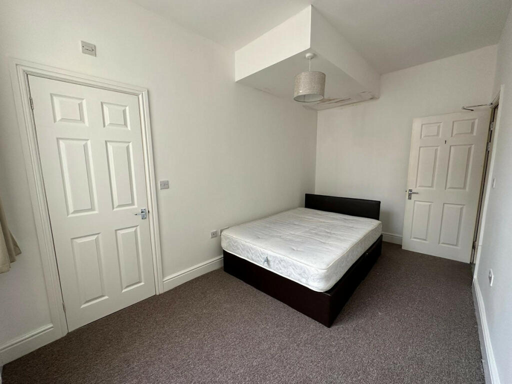
Room to Rent! Discover an affordable share accommodation rental on South Street in Rotherham
- Bedrooms
- 1
- Bathrooms
- 1
The heatmap indicates the level of crime in the area. The color of the heatmap indicates the crime severity and recency.
Metrics Year-on-Year
- Average area value
- 1,363,333.00 £Increased by 35.76 %
- Average area rental value
- 2,132.00 £/moIncreased by 10.07 %
- Est rental Yield
- 1.88 %Decreased by 18.61 %
- Crime Rate
- 17.00 %Unchanged by 0.00 %
from 1,004,229.00 £
from 1,937.00 £/mo
from 2.31 %
from 17.00 %
Agent Activity
BRH created the listing.
Nearby Schools
| Name | Type | Ofsted | Distance |
|---|---|---|---|
| Rawmarsh Ryecroft Infant School | Community School | Good | 0.13 KM |
| Rawmarsh Rosehill Junior School | Community School | Good | 0.35 KM |
| Rawmarsh Nursery School And Childrens Centre | Local Authority Nursery School | Outstanding | 0.83 KM |
| Rotherham Aspire | Pupil Referral Unit | Good | 0.83 KM |
| Rawmarsh Children'S Centre | Children's Centre | 0.90 KM |
Images


Nearby Streets
| Name | Average Price | Average Sqft | Distance |
|---|---|---|---|
| Bisby Road | £ 0 | 0 | 0.00 KM |
| Rockingham Road | £ 125,000 | 0 | 0.00 KM |
| Manor Place | £ 0 | 0 | 0.00 KM |
| Claypit Lane | £ 0 | 0 | 0.00 KM |
| Dale Street | £ 140,000 | 0 | 0.00 KM |
Nearby Transport
| Name | NLC | TLC | Distance |
|---|---|---|---|
| Swinton (South Yorks) | 6686 | SWN | 3.87 KM |
| Rotherham Central | 6676 | RMC | 4.76 KM |
| Mexborough | 6707 | MEX | 5.78 KM |
| Bolton-Upon-Dearne | 8536 | BTD | 6.37 KM |
| Goldthorpe | 8284 | GOE | 7.91 KM |
Nearby Listings
| Address | Price | Type | Score | Distance |
|---|---|---|---|---|
| Kilnhurst Road, Rawmarsh | £ 875 | RENT | Unknown | 0.08 KM |
| Main Street, Rawmarsh, S62 5QP | £ 795 | RENT | Unknown | 0.12 KM |
| Heatons Bank, Rawmarsh | £ 900 | RENT | Unknown | 0.16 KM |
| Kilnhurst Road, Rawmarsh | £ 750 | RENT | Unknown | 0.22 KM |
| North Street, Rotherham | £ 650 | RENT | Unknown | 0.50 KM |
Nearby Properties
| Address | Price | Distance |
|---|---|---|
| 39 Marrion Road | £ 90,000 | 0.06 KM |
| 15 Marrion Road | £ 70,000 | 0.06 KM |
| 37 Marrion Road | £ 123,500 | 0.06 KM |
| 41 Marrion Road | £ 95,000 | 0.06 KM |
| 53 Marrion Road | £ 75,000 | 0.06 KM |