HA
Redcliffe Street, SWINDON
By haart
£ 1,300
haart says ..
**NO DEPOSIT OPTION AVAILABLE**
- Bedrooms
- 3
- Bathrooms
- 2
The heatmap indicates the level of crime in the area. The color of the heatmap indicates the crime severity and recency.
Metrics Year-on-Year
- Average area value
- 245,600.00 £Increased by 19.16 %
- Average area rental value
- 978.00 £/moDecreased by 9.78 %
- Est rental Yield
- 4.78 %Decreased by 24.25 %
- Crime Rate
- 7.00 %Unchanged by 0.00 %
from 206,103.00 £
from 1,084.00 £/mo
from 6.31 %
from 7.00 %
Agent Activity
haart created the listing.
Nearby Schools
| Name | Type | Ofsted | Distance |
|---|---|---|---|
| Even Swindon Primary School | Community School | Good | 0.69 KM |
| Robert Le Kyng Primary School | Community School | Good | 0.74 KM |
| Utc Swindon | University Technical College | Requires improvement | 0.97 KM |
| St Mary'S Catholic Primary School | Academy Converter | Good | 1.66 KM |
| Ferndale Primary School & Nursery | Academy Converter | Good | 1.68 KM |
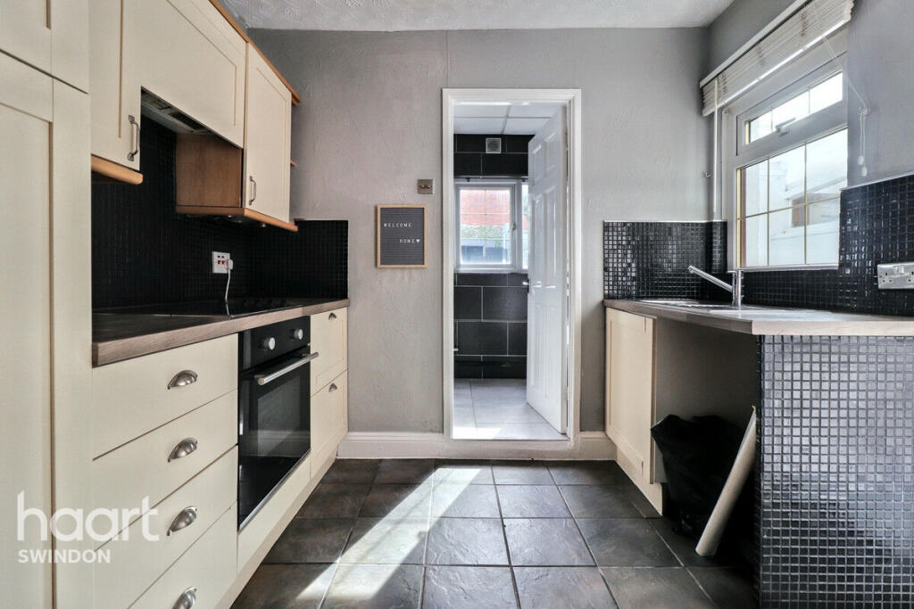
Images


Nearby Streets
| Name | Average Price | Average Sqft | Distance |
|---|---|---|---|
| Turner Street | £ 0 | 0 | 0.00 KM |
| Marlborough Street | £ 0 | 0 | 0.00 KM |
| Canal Cottages | £ 0 | 0 | 0.00 KM |
| Church Place | £ 0 | 0 | 0.00 KM |
| Joseph Street | £ 0 | 0 | 0.00 KM |
Nearby Transport
| Name | NLC | TLC | Distance |
|---|---|---|---|
| Swindon (Wilts) | 3333 | SWI | 1.95 KM |
Nearby Listings
| Address | Price | Type | Score | Distance |
|---|---|---|---|---|
| Redcliffe Street, Swindon, SN2 | £ 1,200 | RENT | Unknown | 0.02 KM |
| Groves Street, Swindon, SN2 | £ 625 | RENT | Unknown | 0.08 KM |
| St. Austell Way, Swindon, SN2 2 | £ 1,000 | RENT | Unknown | 0.14 KM |
| Lynmouth Road, Churchward, Swindon, Wiltshire, SN2 | £ 1,050 | RENT | Unknown | 0.16 KM |
| St. Austell Way, Swindon, SN2 | £ 1,595 | RENT | Unknown | 0.16 KM |
Nearby Properties
| Address | Price | Distance |
|---|---|---|
| 37 Redcliffe Street | £ 154,000 | 0.04 KM |
| 34 Redcliffe Street | £ 123,000 | 0.04 KM |
| 54 Redcliffe Street | £ 159,000 | 0.04 KM |
| 39 Redcliffe Street | £ 113,000 | 0.04 KM |
| 63 Redcliffe Street | £ 125,000 | 0.04 KM |