HA
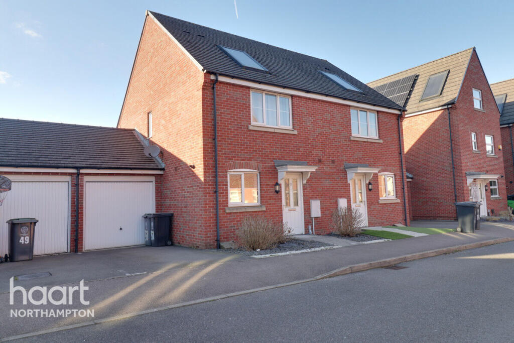
Tyne Way, Rushden
By haart
£ 1,250
haart says ..
MODERN FAMILY HOME
- Bedrooms
- 3
- Bathrooms
- 1
The heatmap indicates the level of crime in the area. The color of the heatmap indicates the crime severity and recency.
Metrics Year-on-Year
- Average area value
- 224,923.00 £Decreased by 19.02 %
- Average area rental value
- 818.00 £/moDecreased by 13.62 %
- Est rental Yield
- 4.36 %Increased by 6.60 %
- Crime Rate
- 4.00 %Unchanged by 0.00 %
from 277,758.00 £
from 947.00 £/mo
from 4.09 %
from 4.00 %
Agent Activity
haart created the listing.
Nearby Schools
| Name | Type | Ofsted | Distance |
|---|---|---|---|
| The Ferrers School | Academy Converter | Good | 0.60 KM |
| Denfield Park Primary School | Community School | Good | 0.89 KM |
| Newton Road Children'S Centre | Children's Centre | 0.92 KM | |
| Newton Road School | Academy Sponsor Led | 1.09 KM | |
| Higham Ferrers Children'S Centre | Children's Centre | 1.15 KM |
Images


Nearby Streets
| Name | Average Price | Average Sqft | Distance |
|---|---|---|---|
| Shannon Close | £ 275,000 | 0 | 0.00 KM |
| High Beech | £ 0 | 0 | 0.00 KM |
| Spring Gardens | £ 0 | 0 | 0.00 KM |
| Edward Close | £ 0 | 0 | 0.00 KM |
| The Old Vineyard | £ 0 | 0 | 0.00 KM |
Nearby Listings
| Address | Price | Type | Score | Distance |
|---|---|---|---|---|
| Upper Queen Street, Rushden, NN10 0BS | £ 1,250 | RENT | Unknown | 0.31 KM |
| NN10, Litchfield Drive, Rushden, Northamptonshire | £ 1,450 | RENT | Unknown | 0.37 KM |
| Allen Road, Rushden | £ 975 | RENT | Unknown | 0.42 KM |
| Knowles Close, Rushden, NN10 | £ 950 | RENT | Unknown | 0.51 KM |
| Whittemore Road, Rushden | £ 995 | RENT | Unknown | 0.52 KM |
Nearby Properties
| Address | Price | Distance |
|---|---|---|
| 12 Tyne Way | £ 154,850 | 0.03 KM |
| 7 Tyne Way | £ 172,000 | 0.03 KM |
| 40 Tyne Way | £ 140,000 | 0.03 KM |
| 3 Tyne Way | £ 149,950 | 0.03 KM |
| 8 Tyne Way | £ 220,000 | 0.03 KM |