HA
High Street, BRISTOL
By haart
£ 2,000
haart says ..
**NO DEPOSIT OPTION AVAILABLE**
- Bedrooms
- 3
- Bathrooms
- 1
The heatmap indicates the level of crime in the area. The color of the heatmap indicates the crime severity and recency.
Metrics Year-on-Year
- Average area value
- 410,714.00 £Increased by 0.52 %
- Average area rental value
- 1,363.00 £/moDecreased by 8.52 %
- Est rental Yield
- 3.98 %Decreased by 9.13 %
- Crime Rate
- 10.00 %Unchanged by 0.00 %
from 408,604.00 £
from 1,490.00 £/mo
from 4.38 %
from 10.00 %
Agent Activity
haart created the listing.
Nearby Schools
| Name | Type | Ofsted | Distance |
|---|---|---|---|
| Sir Bernard Lovell Academy | Academy Sponsor Led | Requires improvement | 0.34 KM |
| St Anne'S Church Of England Primary School | Voluntary Controlled School | Good | 0.48 KM |
| Redfield Edge Primary School | Community School | Good | 0.80 KM |
| Cherry Garden Primary School | Community School | Good | 0.95 KM |
| St Barnabas Cofe Primary School | Voluntary Controlled School | Good | 1.09 KM |
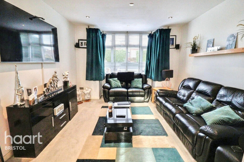
Images


Nearby Streets
| Name | Average Price | Average Sqft | Distance |
|---|---|---|---|
| The Piggaries | £ 0 | 0 | 0.00 KM |
| Tudor Close | £ 312,500 | 0 | 0.00 KM |
| Chequers Close | £ 600,000 | 0 | 0.00 KM |
| The Paddock | £ 0 | 0 | 0.00 KM |
| Barry Road | £ 450,000 | 0 | 0.00 KM |
Nearby Transport
| Name | NLC | TLC | Distance |
|---|---|---|---|
| Keynsham | 3237 | KYN | 3.83 KM |
Nearby Listings
| Address | Price | Type | Score | Distance |
|---|---|---|---|---|
| High Street, Oldland Common, Bristol | £ 1,250 | RENT | Unknown | 0.05 KM |
| High Street, Bristol | £ 1,095 | RENT | Unknown | 0.08 KM |
| West Street, Oldland Common, Bristol, BS30 | £ 1,200 | RENT | Unknown | 0.29 KM |
| North Street, Oldland Common, Bristol | £ 1,850 | RENT | Unknown | 0.31 KM |
| North Street, Oldland Common, Bristol | £ 1,750 | RENT | Unknown | 0.31 KM |
Nearby Properties
| Address | Price | Distance |
|---|---|---|
| 162 High Street | £ 242,500 | 0.06 KM |
| 170 High Street | £ 385,000 | 0.06 KM |
| 172 High Street | £ 300,000 | 0.06 KM |
| 150 High Street | £ 238,000 | 0.06 KM |
| 158 High Street | £ 410,000 | 0.06 KM |