DA
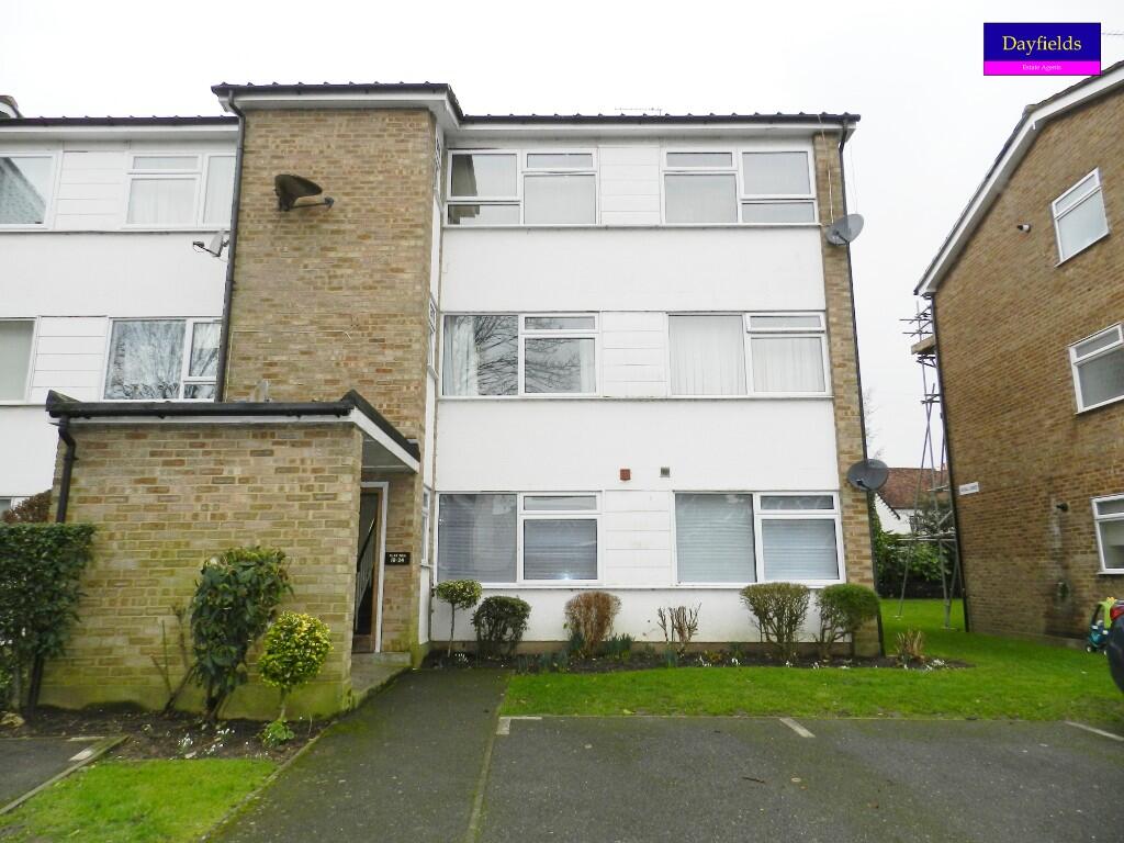
High Road, Broxbourne, Hertfordshire, EN10
By Dayfields
£ 1,400
Dayfields says ..
Two Bedroom Flat, Lounge, Fitted Kitchen, Family Bathroom, Council Tax Band B.
- Bedrooms
- 2
- Bathrooms
- 0
The heatmap indicates the level of crime in the area. The color of the heatmap indicates the crime severity and recency.
Metrics Year-on-Year
- Average area value
- 504,111.00 £Increased by 27.98 %
- Average area rental value
- 1,323.00 £/moDecreased by 9.57 %
- Est rental Yield
- 3.15 %Decreased by 29.37 %
- Crime Rate
- 23.00 %Unchanged by 0.00 %
from 393,910.00 £
from 1,463.00 £/mo
from 4.46 %
from 23.00 %
Agent Activity
Dayfields created the listing.
Nearby Schools
| Name | Type | Ofsted | Distance |
|---|---|---|---|
| The Broxbourne School | Academy Converter | Good | 0.26 KM |
| Wormley Cofe Primary School | Voluntary Controlled School | Good | 0.44 KM |
| Broxbourne Cofe Primary School | Voluntary Aided School | Outstanding | 0.55 KM |
| Sheredes Primary School | Community School | Outstanding | 1.48 KM |
| B3 High Trees Family Centre | Children's Centre | 1.69 KM |
Images


Nearby Streets
| Name | Average Price | Average Sqft | Distance |
|---|---|---|---|
| Badgers Walk | £ 0 | 0 | 0.00 KM |
| Alderman Place | £ 0 | 0 | 0.00 KM |
| Dunbar Grove | £ 0 | 0 | 0.00 KM |
| Christie Close | £ 0 | 0 | 0.00 KM |
| Roslyn Close | £ 735,000 | 0 | 0.00 KM |
Nearby Transport
| Name | NLC | TLC | Distance |
|---|---|---|---|
| Broxbourne | 6812 | BXB | 1.50 KM |
| Cheshunt | 6814 | CHN | 4.05 KM |
| Rye House | 6820 | RYH | 4.56 KM |
| Theobalds Grove | 6949 | TEO | 5.39 KM |
| St Margarets (Herts) | 6821 | SMT | 6.00 KM |
Nearby Listings
| Address | Price | Type | Score | Distance |
|---|---|---|---|---|
| Hadleigh Court, High Road, Broxbourne, EN10 | £ 1,395 | RENT | Unknown | 0.00 KM |
| High Road, Broxbourne | £ 1,450 | RENT | Unknown | 0.02 KM |
| De Burgh Close, Broxbourne, Hertfordshire, EN10 | £ 2,400 | RENT | Unknown | 0.03 KM |
| De Burgh Close, BROXBOURNE | £ 2,250 | RENT | Unknown | 0.08 KM |
| High Road, Broxbourne | £ 2,500 | RENT | Unknown | 0.16 KM |
Nearby Properties
| Address | Price | Distance |
|---|---|---|
| 12 Lichfield Way | £ 239,950 | 0.06 KM |
| 8 Lichfield Way | £ 400,000 | 0.06 KM |
| 7 Lichfield Way | £ 435,000 | 0.06 KM |
| 5 Lichfield Way | £ 305,000 | 0.06 KM |
| 15 Lichfield Way | £ 357,500 | 0.06 KM |