ST
Honiton
By Stags
£ 200,000
Stags says ..
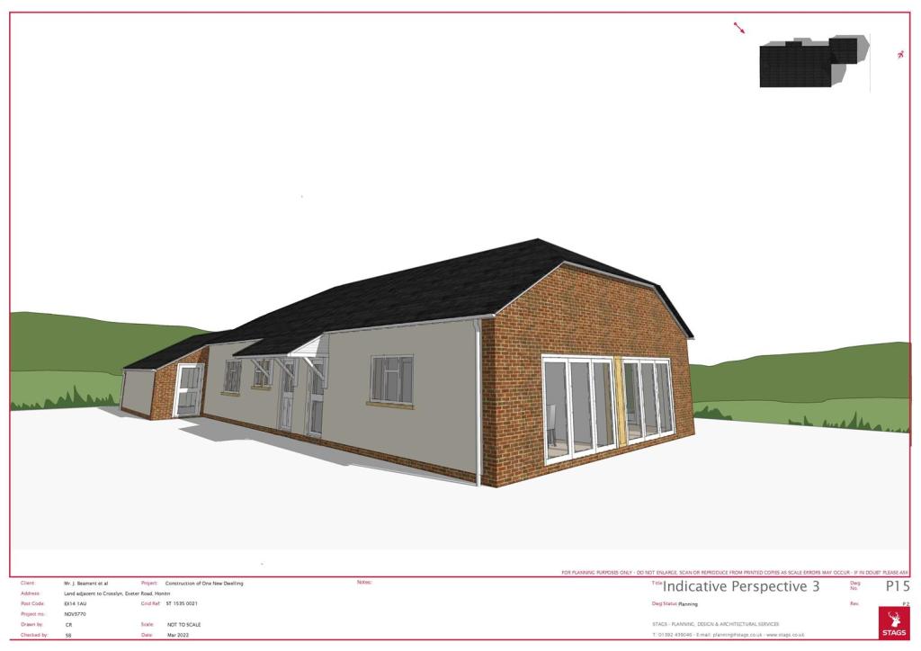
Individual building plot tucked away yet accessible in over 1/5 acre. Council Tax TBC. Freehold.
- Bedrooms
- 4
- Bathrooms
- 2
The heatmap indicates the level of crime in the area. The color of the heatmap indicates the crime severity and recency.
Metrics Year-on-Year
- Average area value
- 322,500.00 £Increased by 7.16 %
- Average area rental value
- 850.00 £/moDecreased by 16.58 %
- Est rental Yield
- 3.16 %Decreased by 22.17 %
- Crime Rate
- 8.00 %Unchanged by 0.00 %
from 300,948.00 £
from 1,019.00 £/mo
from 4.06 %
from 8.00 %
Agent Activity
Stags created the listing.
Nearby Schools
| Name | Type | Ofsted | Distance |
|---|---|---|---|
| Honiton & District Children'S Centre | Children's Centre | 1.20 KM | |
| Littletown Primary Academy | Academy Converter | Good | 1.27 KM |
| Honiton Community College | Academy Converter | Good | 1.40 KM |
| Honiton Primary School | Community School | Requires improvement | 1.71 KM |
| Awliscombe Church Of England Primary School | Voluntary Aided School | Good | 3.37 KM |
Images


Nearby Streets
| Name | Average Price | Average Sqft | Distance |
|---|---|---|---|
| St Paul's Road | £ 195,000 | 0 | 0.00 KM |
| Otter Moor Lane | £ 314,490 | 0 | 0.00 KM |
| Ottery Moor Road | £ 350,000 | 0 | 0.00 KM |
| St Mark's Road | £ 0 | 0 | 0.00 KM |
| Hawthorn Close | £ 0 | 0 | 0.00 KM |
Nearby Transport
| Name | NLC | TLC | Distance |
|---|---|---|---|
| Honiton | 5717 | HON | 1.66 KM |
| Feniton | 5808 | FNT | 9.31 KM |
Nearby Listings
| Address | Price | Type | Score | Distance |
|---|---|---|---|---|
| Honiton | £ 200,000 | COMMERCIAL_BUY | Unknown | 0.00 KM |
Nearby Properties
| Address | Price | Distance |
|---|---|---|
| White Heather | £ 290,000 | 0.01 KM |
| Crossways | £ 285,000 | 0.01 KM |
| Bon Heur | £ 240,000 | 0.01 KM |
| Linden | £ 310,000 | 0.01 KM |
| Kynaston | £ 425,000 | 0.01 KM |