
Station Road, London, N11 1QE
By Property Hub
£ 2,500
Property Hub says ..
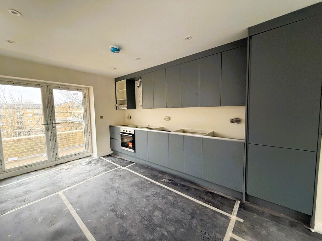
Property located in Station Road, London, N11 1QE
- Bedrooms
- 3
- Bathrooms
- 1
The heatmap indicates the level of crime in the area. The color of the heatmap indicates the crime severity and recency.
Metrics Year-on-Year
- Average area value
- 793,750.00 £Decreased by 0.58 %
- Average area rental value
- 1,954.00 £/moIncreased by 5.97 %
- Est rental Yield
- 2.95 %Increased by 6.50 %
- Crime Rate
- 22.00 %Unchanged by 0.00 %
from 798,378.00 £
from 1,844.00 £/mo
from 2.77 %
from 22.00 %
Agent Activity
Property Hub created the listing.
Nearby Schools
| Name | Type | Ofsted | Distance |
|---|---|---|---|
| St Paul'S Cofe Primary School N11 | Voluntary Aided School | Good | 0.14 KM |
| Bowes And Garfield Children'S Centre | Children's Centre | 0.71 KM | |
| Our Lady Of Lourdes Catholic Primary School | Voluntary Aided School | Good | 0.78 KM |
| Garfield Primary School | Community School | Good | 0.79 KM |
| Holly Park Primary School | Community School | Good | 0.88 KM |
Images


Nearby Streets
| Name | Average Price | Average Sqft | Distance |
|---|---|---|---|
| Regal Drive | £ 0 | 0 | 0.00 KM |
| Beaconsfield Close | £ 0 | 0 | 0.00 KM |
| Cross Road | £ 0 | 0 | 0.00 KM |
| Alexandra Road | £ 0 | 0 | 0.00 KM |
| Silver Birch Close | £ 0 | 0 | 0.00 KM |
Nearby Transport
| Name | NLC | TLC | Distance |
|---|---|---|---|
| New Southgate | 6019 | NSG | 0.14 KM |
| Bowes Park | 6027 | BOP | 2.68 KM |
| Alexandra Palace | 6025 | AAP | 3.20 KM |
| Oakleigh Park | 6020 | OKL | 3.55 KM |
| Palmers Green | 6021 | PAL | 3.65 KM |
Nearby Listings
| Address | Price | Type | Score | Distance |
|---|---|---|---|---|
| Moorgate Court, Station Road N11 | £ 1,700 | RENT | Unknown | 0.01 KM |
| Friern Barnet Road, London, N11 | £ 1,500 | RENT | Unknown | 0.04 KM |
| Friern Barnet Road, London, N11 | £ 1,900 | RENT | Unknown | 0.04 KM |
| Friern Barnet Road, Friern Barnet, N11 | £ 1,600 | RENT | Unknown | 0.05 KM |
| Friern Barnet Road, London, N11 | £ 750 | RENT | Unknown | 0.05 KM |
Nearby Properties
| Address | Price | Distance |
|---|---|---|
| 110 Station Road | £ 20,000 | 0.02 KM |
| 26b Friern Barnet Road | £ 239,000 | 0.04 KM |
| 28 Friern Barnet Road | £ 150,000 | 0.04 KM |
| 153 High Road | £ 203,000 | 0.12 KM |
| 207 High Road | £ 242,500 | 0.12 KM |