HA
Durfold Drive, Reigate, RH2
By Halliwell Marks
£ 2,300
Halliwell Marks says ..
.
- Bedrooms
- 3
- Bathrooms
- 1
The heatmap indicates the level of crime in the area. The color of the heatmap indicates the crime severity and recency.
Metrics Year-on-Year
- Average area value
- 815,909.00 £Increased by 12.95 %
- Average area rental value
- 1,831.00 £/moIncreased by 12.12 %
- Est rental Yield
- 2.69 %Decreased by 0.74 %
- Crime Rate
- 6.00 %Unchanged by 0.00 %
from 722,332.00 £
from 1,633.00 £/mo
from 2.71 %
from 6.00 %
Agent Activity
Halliwell Marks created the listing.
Nearby Schools
| Name | Type | Ofsted | Distance |
|---|---|---|---|
| Reigate Grammar School | Other Independent School | 0.26 KM | |
| Reigate Parish Church Primary School | Voluntary Aided School | Outstanding | 0.39 KM |
| Brooklands School - Split Site | Community Special School | Good | 0.76 KM |
| Reigate College | Academy 16-19 Converter | Outstanding | 1.08 KM |
| Wray Common Primary School | Academy Converter | 1.16 KM |
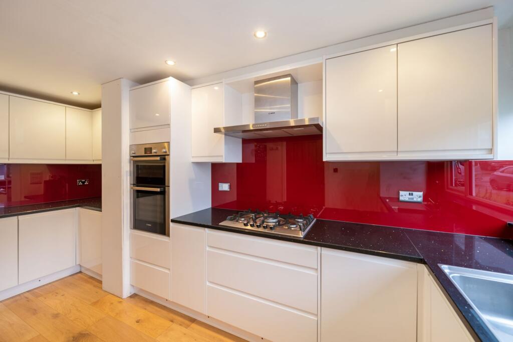
Images


Nearby Streets
| Name | Average Price | Average Sqft | Distance |
|---|---|---|---|
| Doods Brow Cottages | £ 0 | 0 | 0.00 KM |
| St. David's Close | £ 0 | 0 | 0.00 KM |
| Monks Court | £ 325,000 | 0 | 0.00 KM |
| Oak Road | £ 1,250,000 | 0 | 0.00 KM |
| Millway | £ 1,850,000 | 0 | 0.00 KM |
Nearby Transport
| Name | NLC | TLC | Distance |
|---|---|---|---|
| Reigate | 5480 | REI | 1.27 KM |
| Earlswood (Surrey) | 5414 | ELD | 2.74 KM |
| Redhill | 5478 | RDH | 2.97 KM |
| Salfords (Surrey) | 5380 | SAF | 5.32 KM |
| Merstham | 5475 | MHM | 5.48 KM |
Nearby Listings
| Address | Price | Type | Score | Distance |
|---|---|---|---|---|
| Durfold Drive, Reigate, Surrey, RH2 | £ 2,100 | RENT | Unknown | 0.02 KM |
| Durfold Drive, Reigate, Surrey, RH2 | £ 2,150 | RENT | Unknown | 0.07 KM |
| Reigate Road Reigate RH2 | £ 2,750 | RENT | Unknown | 0.17 KM |
| Reigate Road, Reigate, RH2 | £ 1,475 | RENT | Unknown | 0.17 KM |
| Doods Park Road, Reigate, RH2 | £ 2,350 | RENT | Unknown | 0.20 KM |
Nearby Properties
| Address | Price | Distance |
|---|---|---|
| 12 Durfold Drive | £ 440,000 | 0.07 KM |
| 9 Durfold Drive | £ 454,000 | 0.07 KM |
| 10 Durfold Drive | £ 227,500 | 0.07 KM |
| 13 Durfold Drive | £ 489,950 | 0.07 KM |
| 27 Durfold Drive | £ 492,000 | 0.07 KM |