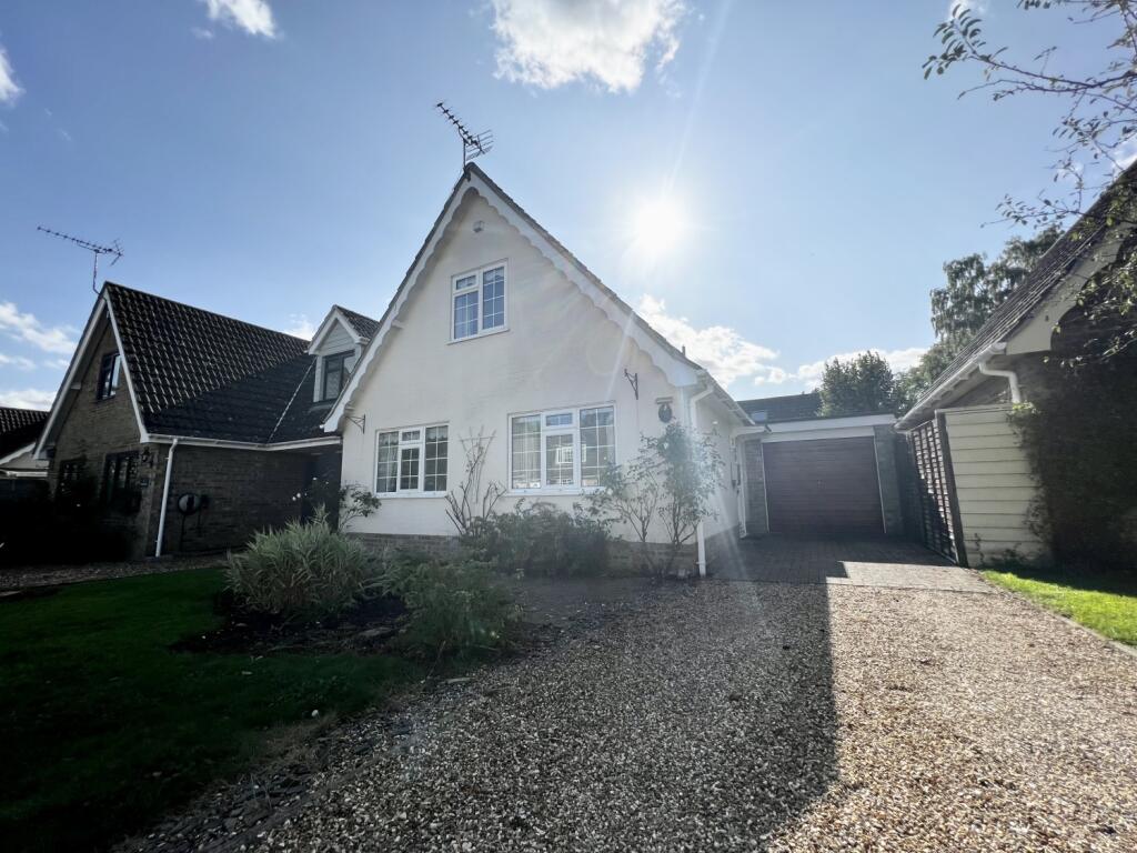

Hazel Drive, Horringer, Suffolk, IP29
By Elvin Estates
£ 1,150
Elvin Estates says ..
SOUGHT AFTER VILLAGE || GARAGE AND DRIVEWAY || THREE BEDROOMS || CLOSE TO BURY ST EDMUNDS || 6 MONTH TENANCY
- Bedrooms
- 3
- Bathrooms
- 1
The heatmap indicates the level of crime in the area. The color of the heatmap indicates the crime severity and recency.
Metrics Year-on-Year
- Average area value
- 223,188.00 £Decreased by 13.36 %
- Average area rental value
- 1,283.00 £/moIncreased by 2.15 %
- Est rental Yield
- 6.90 %Increased by 17.95 %
- Crime Rate
- 9.00 %Unchanged by 0.00 %
from 257,594.00 £
from 1,256.00 £/mo
from 5.85 %
from 9.00 %
Agent Activity
Elvin Estates created the listing.
Nearby Schools
| Name | Type | Ofsted | Distance |
|---|---|---|---|
| Ickworth Park Primary School | Community School | Good | 0.16 KM |
| Horringer Court Middle School | Academy Converter | Good | 2.34 KM |
| Westley Middle School | Academy Converter | Good | 3.10 KM |
| Sexton'S Manor Community Primary School | Community School | Good | 3.54 KM |
| Westgate Community Primary School And Nursery | Community School | Good | 3.95 KM |
Images


Nearby Streets
| Name | Average Price | Average Sqft | Distance |
|---|---|---|---|
| Meadow Drive | £ 0 | 0 | 0.00 KM |
| Orchard Way | £ 500,000 | 0 | 0.00 KM |
| The Oaks | £ 0 | 0 | 0.00 KM |
Nearby Transport
| Name | NLC | TLC | Distance |
|---|---|---|---|
| Bury St Edmunds | 7008 | BSE | 5.79 KM |
Nearby Listings
| Address | Price | Type | Score | Distance |
|---|---|---|---|---|
| MANOR LANE, HORRINGER, BURY ST EDMUNDS IP29 5PY | £ 2,300 | RENT | Unknown | 0.52 KM |
| The Street, Horringer, IP29 | £ 2,350 | RENT | Unknown | 0.59 KM |
| Westley Lane, Horringer, Bury St. Edmunds, IP29 | £ 1,400 | RENT | Unknown | 0.73 KM |
| Place Farm Drive, Whepstead Road, Horringer, Bury St Edmunds, IP29 | £ 1,400 | RENT | Unknown | 1.64 KM |
Nearby Properties
| Address | Price | Distance |
|---|---|---|
| 2 Hazel Drive | £ 312,500 | 0.01 KM |
| 5 Hazel Drive | £ 205,000 | 0.01 KM |
| 1 Hazel Drive | £ 249,950 | 0.01 KM |
| 10 Hazel Drive | £ 200,000 | 0.01 KM |
| 6 Hazel Drive | £ 136,000 | 0.01 KM |