St. Michaels Road, Bournemouth, BH2
By Taylor Made
£ 375,000
Reviews
3 out of 5 stars
Taylor Made says ..
A TWO DOUBLE BEDROOM MEWS HOUSE SITUATED WITHIN THIS PRIVATE GATED CUL-DE-SAC MOMENTS FROM BOURNEMOUTH BEACH. Private patio area, Garage, viewing highly recommended.
Property Oracle says ..
The property is located on St. Michaels Road in Bournemouth, a desirable area in the Westbourne & West Cliff locality. The average house price in the area is £319,243, with an average price per square foot of £399. The property’s list price of £375,000 is slightly above the average, but comparable to other properties on St. Michaels Road. The proximity to Bournemouth railway station (2.41 KM) provides convenient access to transportation. Several well-regarded schools, including St Michael’s Church of England Primary School (0.53 KM) and Kings Bournemouth (1.30 KM), are within a reasonable distance. This suggests a good location score.
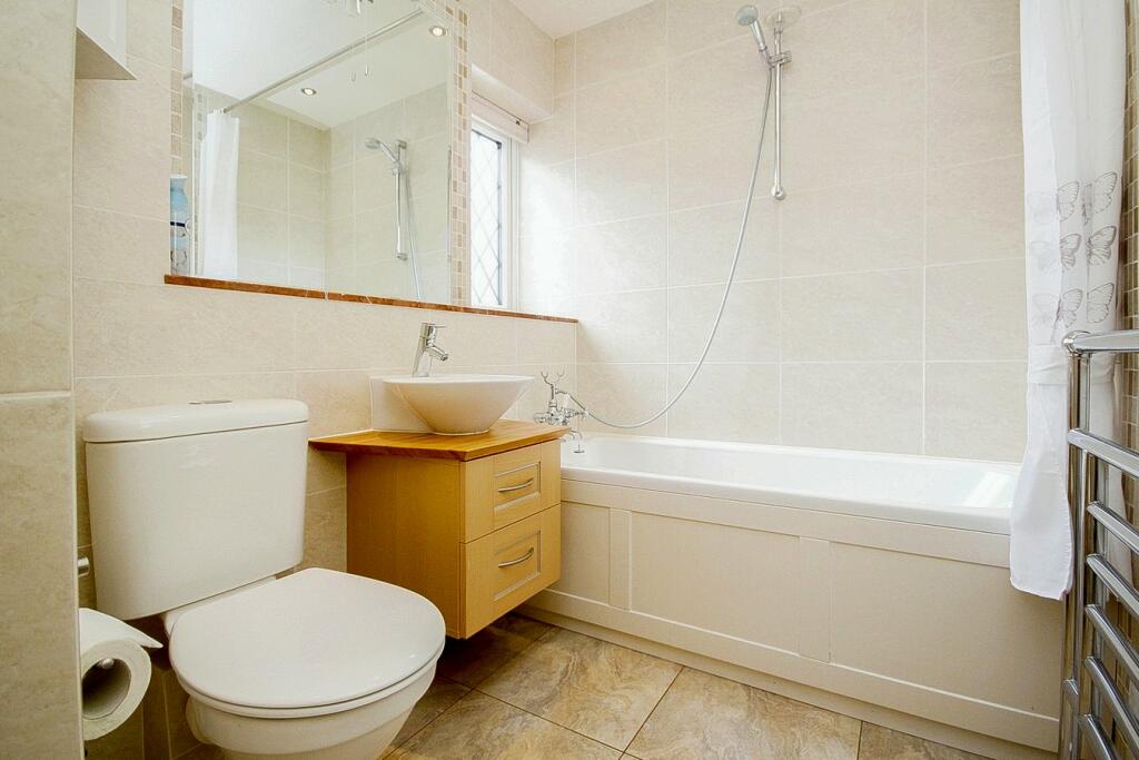
Based on the provided images, the property appears to be in good condition. The interior is well-maintained, with modern fixtures and fittings in the kitchen and bathrooms. There is no visible evidence of significant wear and tear or the need for major renovations. The property benefits from a small, well-maintained patio area, though the plot size is listed as 0.00 sqft. The lack of substantial outdoor space might impact the land score.
The property’s list price of £375,000, considering its location, apparent condition, and the limited outdoor space, seems reasonably priced. While slightly above the average price for the area, comparable properties on St. Michaels Road are listed at similar prices. The property’s size (889 sqft) is larger than the average (800 sqft) in the area, further supporting the price point.
Therefore, we give this property 6 / 10. *Disclaimer: This is our option and does constitute a recommendation or financial advice. Do your own research. *
- Price
- 7
- Condition
- 8
- Location
- 8
- Land
- 4
- Bedrooms
- 2
- Bathrooms
- 2
- Sqft (est)
- 889.00
The heatmap indicates the level of crime in the area. The color of the heatmap indicates the crime severity and recency.
Metrics Year-on-Year
- Average area value
- 376,737.00 £Increased by 7.60 %
- Est sale value
- 415,163.00 £Increased by 24.20 %
- Average area rental value
- 1,284.00 £/moDecreased by 2.65 %
- Est letting value
- 889.00 £/moUnchanged by 0.00 %
- Est rental Yield
- 4.09 %Decreased by 9.51 %
- Crime Rate
- 25.00 %Unchanged by 0.00 %
Agent Activity
Taylor Made created the listing.
Nearby Schools
| Name | Type | Ofsted | Distance |
|---|---|---|---|
| St Michael'S Church Of England Primary School | Academy Converter | Good | 0.53 KM |
| Kings Bournemouth | Other Independent School | Good | 1.30 KM |
| Bournemouth Christian School | Other Independent School | Good | 1.79 KM |
| Livingstone Academy Bournemouth | Free Schools | 1.86 KM | |
| St Martin'S School | Other Independent School | 2.16 KM |
Images


Nearby Streets
| Name | Average Price | Average Sqft | Distance |
|---|---|---|---|
| West Cliff Promenade | £ 0 | 0 | 0.00 KM |
| Durley Roundabout | £ 332,980 | 0 | 0.00 KM |
| Avenue Road | £ 200,000 | 0 | 0.00 KM |
| Bournemouth Square | £ 0 | 0 | 0.00 KM |
| St Stephen's Road | £ 0 | 0 | 0.00 KM |
Nearby Transport
| Name | NLC | TLC | Distance |
|---|---|---|---|
| Bournemouth | 5876 | BMH | 2.41 KM |
| Branksome | 5875 | BSM | 4.11 KM |
| Pokesdown | 5885 | POK | 6.68 KM |
| Parkstone (Dorset) | 5882 | PKS | 7.11 KM |
Nearby Listings
| Address | Price | Type | Score | Distance |
|---|---|---|---|---|
| St. Michaels Road, Bournemouth, BH2 | £ 375,000 | BUY | 6 / 10 | 0.00 KM |
| West Cliff Mews, St. Michaels Road, West Cliff, Bournemouth, BH2 | £ 350,000 | BUY | 5 / 10 | 0.02 KM |
| St Michaels Road, Bournemouth, BH2 | £ 375,000 | BUY | 8 / 10 | 0.02 KM |
| St. Michaels Road, Bournemouth | £ 220,000 | BUY | 6 / 10 | 0.04 KM |
| St. Michaels Road, Bournemouth, Dorset, BH2 | £ 125,000 | BUY | 5 / 10 | 0.04 KM |
Nearby Properties
| Address | Price | Distance |
|---|---|---|
| 121 West Hill Road | £ 245,000 | 0.07 KM |
| 30a Tregonwell Road | £ 765,000 | 0.15 KM |
| 32 St Michaels Road | £ 320,000 | 0.16 KM |
| 28 St Michaels Road | £ 220,000 | 0.16 KM |
| 30 St Michaels Road | £ 315,000 | 0.16 KM |