UN
5 North Road
£ 124,000
Description
We don't have a Description for this property.
- Bedrooms
- 2
- Bathrooms
- 0

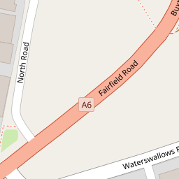

Leaflet © OpenStreetMap contributors
The heatmap indicates the level of crime in the area. The color of the heatmap indicates the crime severity and recency.
Metrics Year-on-Year
- Average area value
- 295,393.00 £Increased by 8.41 %
- Average area rental value
- 1,058.00 £/moIncreased by 8.51 %
- Est rental Yield
- 4.30 %Increased by 0.23 %
- Crime Rate
- 11.00 %Unchanged by 0.00 %
from 272,471.00 £
from 975.00 £/mo
from 4.29 %
from 11.00 %
Nearby Schools
| Name | Type | Ofsted | Distance |
|---|---|---|---|
| Fairfield Infant And Nursery School | Community School | Good | 0.50 KM |
| Fairfield Endowed Cofe (C) Junior School | Voluntary Controlled School | Good | 0.77 KM |
| Fairfield Children'S Centre | Children's Centre | 0.78 KM | |
| St Anne'S Catholic Voluntary Academy | Academy Converter | 1.31 KM | |
| Buxton Infant School | Community School | Outstanding | 1.41 KM |
Images
Nearby Streets
| Name | Average Price | Average Sqft | Distance |
|---|---|---|---|
| Queens Avenue | £ 0 | 0 | 0.00 KM |
| Dale Lane | £ 0 | 0 | 0.00 KM |
| Dale Lane | £ 0 | 0 | 0.00 KM |
| Thorn Close | £ 145,000 | 0 | 0.00 KM |
| Lightwood Road | £ 217,498 | 0 | 0.00 KM |
Nearby Transport
| Name | NLC | TLC | Distance |
|---|---|---|---|
| Buxton | 2946 | BUX | 1.42 KM |
| Dove Holes | 2766 | DVH | 4.16 KM |
| Chapel-En-Le-Frith | 2762 | CEF | 5.71 KM |
| Chinley | 2823 | CLY | 9.73 KM |
Nearby Listings
| Address | Price | Type | Score | Distance |
|---|---|---|---|---|
| Fairfield Road, Buxton | £ 1,000,000 | BUY | 6 / 10 | 0.15 KM |
| Cross Street, Buxton | £ 169,995 | BUY | Unknown | 0.21 KM |
| Fairfield Road, Buxton | £ 115,000 | BUY | 7 / 10 | 0.21 KM |
| St. Peters Road, Buxton | £ 475,000 | BUY | 8 / 10 | 0.22 KM |
| Alma Street, Buxton | £ 180,000 | BUY | 4 / 10 | 0.22 KM |
Nearby Properties
| Address | Price | Distance |
|---|---|---|
| 5 North Road | £ 124,000 | 0.00 KM |
| 6 North Road | £ 75,000 | 0.00 KM |
| 14 North Road | £ 156,000 | 0.00 KM |
| 10 North Road | £ 120,000 | 0.02 KM |
| 16 North Road | £ 180,000 | 0.02 KM |