UN
2 Canopy Lane
£ 473,000
Description
We don't have a Description for this property.
- Bedrooms
- 3
- Bathrooms
- 0
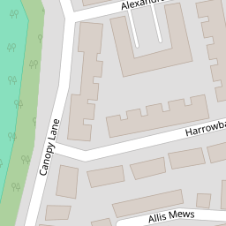


Leaflet © OpenStreetMap contributors
The heatmap indicates the level of crime in the area. The color of the heatmap indicates the crime severity and recency.
Metrics Year-on-Year
- Average area value
- 582,075.00 £Increased by 36.93 %
- Average area rental value
- 1,398.00 £/moDecreased by 18.86 %
- Est rental Yield
- 2.88 %Decreased by 40.74 %
- Crime Rate
- 11.00 %Unchanged by 0.00 %
from 425,076.00 £
from 1,723.00 £/mo
from 4.86 %
from 11.00 %
Nearby Schools
| Name | Type | Ofsted | Distance |
|---|---|---|---|
| Newhall Primary Academy | Free Schools | 0.70 KM | |
| Mark Hall Academy | Academy Sponsor Led | 0.76 KM | |
| Church Langley Community Primary School | Community School | Good | 0.76 KM |
| Fawbert And Barnard'S Primary School | Academy Converter | 0.89 KM | |
| Henry Moore Primary School | Academy Converter | Good | 1.33 KM |
Images
Nearby Streets
| Name | Average Price | Average Sqft | Distance |
|---|---|---|---|
| Currant Road | £ 0 | 0 | 0.00 KM |
| Barnfield Way | £ 0 | 0 | 0.00 KM |
| Percheron Way | £ 0 | 0 | 0.00 KM |
| Trefoil Lane | £ 0 | 0 | 0.00 KM |
| Spicers Lane | £ 0 | 0 | 0.00 KM |
Nearby Transport
| Name | NLC | TLC | Distance |
|---|---|---|---|
| Harlow Mill | 6804 | HWM | 1.89 KM |
| Harlow Town | 6827 | HWN | 4.50 KM |
| Sawbridgeworth | 6806 | SAW | 5.33 KM |
Nearby Listings
| Address | Price | Type | Score | Distance |
|---|---|---|---|---|
| Harrowbond Road, Newhall, CM17 | £ 600,000 | BUY | 8 / 10 | 0.06 KM |
| Tatton Street, Newhall, HARLOW | £ 500,000 | BUY | 7 / 10 | 0.08 KM |
| Allis Mews, Harlow, CM17 | £ 225,000 | BUY | 5 / 10 | 0.09 KM |
| Milestone Road, Newhall, Harlow, Essex, CM17 | £ 240,000 | BUY | Unknown | 0.10 KM |
| Milestone Road, Newhall, Harlow | £ 500,000 | BUY | 7 / 10 | 0.14 KM |
Nearby Properties
| Address | Price | Distance |
|---|---|---|
| 14 Canopy Lane | £ 194,000 | 0.00 KM |
| 4 Canopy Lane | £ 390,000 | 0.00 KM |
| 15 Canopy Lane | £ 168,375 | 0.00 KM |
| 2 Canopy Lane | £ 473,000 | 0.00 KM |
| 16 Canopy Lane | £ 205,000 | 0.00 KM |