UN
36 Church Lane
£ 627,000
Description
We don't have a Description for this property.
- Bedrooms
- 4
- Bathrooms
- 0
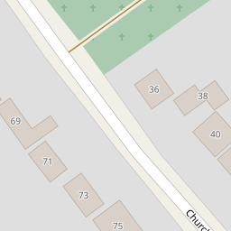
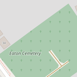


Leaflet © OpenStreetMap contributors
The heatmap indicates the level of crime in the area. The color of the heatmap indicates the crime severity and recency.
Metrics Year-on-Year
- Average area value
- 443,510.00 £Decreased by 7.32 %
- Average area rental value
- 1,591.00 £/moDecreased by 6.36 %
- Est rental Yield
- 4.30 %Increased by 0.94 %
- Crime Rate
- 2.00 %Unchanged by 0.00 %
from 478,523.00 £
from 1,699.00 £/mo
from 4.26 %
from 2.00 %
Nearby Schools
| Name | Type | Ofsted | Distance |
|---|---|---|---|
| Eaton Primary School | Academy Sponsor Led | Good | 0.86 KM |
| Eaton Hall Specialist Academy | Academy Special Converter | Outstanding | 1.32 KM |
| Colman Junior School | Community School | Good | 1.85 KM |
| The Clare School | Foundation Special School | Outstanding | 1.90 KM |
| Colman Infant School | Community School | Outstanding | 1.99 KM |
Images
Nearby Streets
| Name | Average Price | Average Sqft | Distance |
|---|---|---|---|
| Birkdale | £ 600,000 | 0 | 0.00 KM |
| Aspen Way | £ 0 | 0 | 0.00 KM |
| Claremont Road | £ 1,100,000 | 0 | 0.00 KM |
| Waverley Road | £ 750,000 | 0 | 0.00 KM |
Nearby Transport
| Name | NLC | TLC | Distance |
|---|---|---|---|
| Norwich | 7309 | NRW | 6.09 KM |
Nearby Listings
| Address | Price | Type | Score | Distance |
|---|---|---|---|---|
| Chandlers Court, Eaton, Norwich, Norfolk, NR4 | £ 325,000 | BUY | Unknown | 0.19 KM |
| Buckland Rise, Eaton | £ 375,000 | BUY | Unknown | 0.23 KM |
| Buckland Rise, Eaton | £ 350,000 | BUY | 6 / 10 | 0.25 KM |
| Albury Walk, Eaton | £ 240,000 | BUY | Unknown | 0.31 KM |
| Ebbisham Drive, Eaton | £ 575,000 | BUY | Unknown | 0.35 KM |
Nearby Properties
| Address | Price | Distance |
|---|---|---|
| 54 Church Lane | £ 690,000 | 0.00 KM |
| 89 Church Lane | £ 845,000 | 0.00 KM |
| 32 Church Lane | £ 385,000 | 0.00 KM |
| 36 Church Lane | £ 627,000 | 0.00 KM |
| 75 Church Lane | £ 650,000 | 0.00 KM |