UN
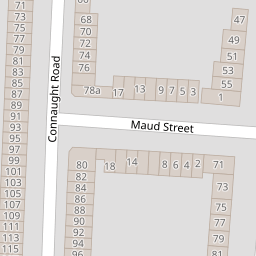
15 Maud Street
£ 181,000
Description
We don't have a Description for this property.
- Bedrooms
- 2
- Bathrooms
- 0


Leaflet © OpenStreetMap contributors
The heatmap indicates the level of crime in the area. The color of the heatmap indicates the crime severity and recency.
Metrics Year-on-Year
- Average area value
- 289,253.00 £Increased by 24.44 %
- Average area rental value
- 1,192.00 £/moIncreased by 0.68 %
- Est rental Yield
- 4.95 %Decreased by 18.99 %
- Crime Rate
- 2.00 %Unchanged by 0.00 %
from 232,435.00 £
from 1,184.00 £/mo
from 6.11 %
from 2.00 %
Nearby Schools
| Name | Type | Ofsted | Distance |
|---|---|---|---|
| Red Balloon - Norwich | Other Independent School | 0.28 KM | |
| Notre Dame Preparatory School (Norwich) Limited | Other Independent School | 0.47 KM | |
| Recreation Road Infant School | Community School | Outstanding | 0.58 KM |
| The Parkside School, Norwich | Foundation Special School | Outstanding | 0.60 KM |
| Nelson Infant School | Academy Sponsor Led | 0.61 KM |
Images
Nearby Streets
| Name | Average Price | Average Sqft | Distance |
|---|---|---|---|
| Havelock Road | £ 250,000 | 0 | 0.00 KM |
| Finchley Court | £ 225,000 | 0 | 0.00 KM |
| Hawthorne Row | £ 0 | 0 | 0.00 KM |
| Arderon Court | £ 0 | 0 | 0.00 KM |
| The Elms | £ 0 | 0 | 0.00 KM |
Nearby Transport
| Name | NLC | TLC | Distance |
|---|---|---|---|
| Norwich | 7309 | NRW | 3.68 KM |
Nearby Listings
| Address | Price | Type | Score | Distance |
|---|---|---|---|---|
| St Philips Road, Norwich | £ 550,000 | BUY | 7 / 10 | 0.07 KM |
| St Philips Road, Norwich | £ 450,000 | BUY | 6 / 10 | 0.09 KM |
| Strafford Street, Norwich | £ 280,000 | BUY | 6 / 10 | 0.09 KM |
| Connaught Road, Norwich, Norfolk | £ 280,000 | BUY | Unknown | 0.09 KM |
| Golden Triangle, NR2 | £ 300,000 | BUY | Unknown | 0.09 KM |
Nearby Properties
| Address | Price | Distance |
|---|---|---|
| 15 Maud Street | £ 181,000 | 0.00 KM |
| 5 Maud Street | £ 290,000 | 0.00 KM |
| 18 Maud Street | £ 219,500 | 0.00 KM |
| 8 Maud Street | £ 125,500 | 0.00 KM |
| 2 Maud Street | £ 168,000 | 0.00 KM |