UN
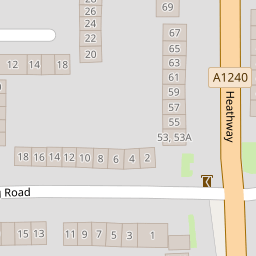
85 Heathway
£ 285,000
Description
We don't have a Description for this property.
- Bedrooms
- 3
- Bathrooms
- 0


Leaflet © OpenStreetMap contributors
The heatmap indicates the level of crime in the area. The color of the heatmap indicates the crime severity and recency.
Metrics Year-on-Year
- Average area value
- 313,929.00 £Decreased by 7.84 %
- Average area rental value
- 1,854.00 £/moIncreased by 19.84 %
- Est rental Yield
- 7.09 %Increased by 30.09 %
- Crime Rate
- 4.00 %Unchanged by 0.00 %
from 340,636.00 £
from 1,547.00 £/mo
from 5.45 %
from 4.00 %
Nearby Schools
| Name | Type | Ofsted | Distance |
|---|---|---|---|
| Thomas Arnold Primary School | Community School | Good | 0.40 KM |
| St Peter'S Catholic Primary School | Voluntary Aided School | Good | 0.47 KM |
| Marsh Green Children'S Centre | Children's Centre Linked Site | 0.55 KM | |
| Marsh Green Primary School | Community School | Good | 0.60 KM |
| William Ford Cofe Junior School | Voluntary Aided School | Outstanding | 0.71 KM |
Images
Nearby Streets
| Name | Average Price | Average Sqft | Distance |
|---|---|---|---|
| Morland Road | £ 175,500 | 0 | 0.00 KM |
| Manning Road | £ 400,000 | 0 | 0.00 KM |
| New Road | £ 370,000 | 0 | 0.00 KM |
| Saint Marks Place | £ 241,250 | 0 | 0.00 KM |
| Crown Street | £ 160,000 | 0 | 0.00 KM |
Nearby Transport
| Name | NLC | TLC | Distance |
|---|---|---|---|
| Dagenham Dock | 7440 | DDK | 0.95 KM |
| Chadwell Heath | 6874 | CTH | 4.27 KM |
| Belvedere | 5092 | BVD | 4.75 KM |
| Rainham (Essex) | 7454 | RNM | 5.14 KM |
| Goodmayes | 6878 | GMY | 5.35 KM |
Nearby Listings
| Address | Price | Type | Score | Distance |
|---|---|---|---|---|
| Heathway, Dagenham, RM9 | £ 450,000 | BUY | 6 / 10 | 0.02 KM |
| Heathway, Dagenham | £ 225,000 | BUY | 6 / 10 | 0.07 KM |
| Darcy Gardens, Dagenham, RM9 | £ 225,000 | BUY | Unknown | 0.10 KM |
| Arnold Road, Dagenham, Essex, RM9 | £ 350,000 | BUY | 5 / 10 | 0.17 KM |
| Digby Gardens, Dagenham, RM10 | £ 350,000 | BUY | Unknown | 0.20 KM |
Nearby Properties
| Address | Price | Distance |
|---|---|---|
| 89 Heathway | £ 199,995 | 0.00 KM |
| 59 Heathway | £ 178,000 | 0.00 KM |
| 85 Heathway | £ 285,000 | 0.00 KM |
| 69 Heathway | £ 82,000 | 0.00 KM |
| 99 Heathway | £ 140,000 | 0.00 KM |