UN
311a Hale Lane
£ 450,000
Description
We don't have a Description for this property.
- Bedrooms
- 2
- Bathrooms
- 0
- Furnished
- true
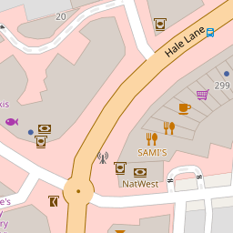


Leaflet © OpenStreetMap contributors
The heatmap indicates the level of crime in the area. The color of the heatmap indicates the crime severity and recency.
Metrics Year-on-Year
- Average area value
- 638,158.00 £Increased by 7.57 %
- Average area rental value
- 2,017.00 £/moIncreased by 6.83 %
- Est rental Yield
- 3.79 %Decreased by 0.79 %
- Crime Rate
- 11.00 %Unchanged by 0.00 %
from 593,240.00 £
from 1,888.00 £/mo
from 3.82 %
from 11.00 %
Nearby Schools
| Name | Type | Ofsted | Distance |
|---|---|---|---|
| Edgware Jewish Girls - Beis Chinuch | Other Independent School | Good | 0.07 KM |
| Beit Shvidler Primary School | Voluntary Aided School | Good | 0.42 KM |
| Edgware Primary School | Community School | Good | 0.65 KM |
| Holland House School | Other Independent School | 0.67 KM | |
| Tashbar Of Edgware | Other Independent School | Inadequate | 0.78 KM |
Images
Nearby Streets
| Name | Average Price | Average Sqft | Distance |
|---|---|---|---|
| Station Road | £ 0 | 0 | 0.00 KM |
| Princes Close | £ 0 | 0 | 0.00 KM |
| Savoy Close | £ 0 | 0 | 0.00 KM |
| Mowbray Parade | £ 199,950 | 0 | 0.00 KM |
| Whitchurch Lane | £ 0 | 0 | 0.00 KM |
Nearby Transport
| Name | NLC | TLC | Distance |
|---|---|---|---|
| Mill Hill Broadway | 1527 | MIL | 2.85 KM |
| Elstree And Borehamwood | 1542 | ELS | 4.17 KM |
| Hendon | 1522 | HEN | 5.65 KM |
| Kenton | 1399 | KNT | 6.01 KM |
| South Kenton | 1453 | SOK | 6.30 KM |
Nearby Listings
| Address | Price | Type | Score | Distance |
|---|---|---|---|---|
| St. Margarets Road, Edgware, HA8 | £ 745,000 | BUY | Unknown | 0.08 KM |
| The Drive, Edgware | £ 350,000 | BUY | 5 / 10 | 0.09 KM |
| Hale Lane, Edgware, HA8 | £ 550,000 | BUY | 6 / 10 | 0.10 KM |
| Gatting Close, Pavilion Way, Edgware, Edgware, HA8 | £ 275,000 | BUY | 5 / 10 | 0.12 KM |
| St. Margarets Road, Edgware | £ 675,000 | BUY | 7 / 10 | 0.12 KM |
Nearby Properties
| Address | Price | Distance |
|---|---|---|
| 311a Hale Lane | £ 450,000 | 0.00 KM |
| 315a Hale Lane | £ 300,000 | 0.00 KM |
| 15a The Promenade | £ 200,000 | 0.10 KM |
| 12a The Promenade | £ 78,000 | 0.10 KM |
| 4 Drive Court | £ 229,000 | 0.10 KM |