UN
21 Heriot Road
£ 483,000
Description
We don't have a Description for this property.
- Bedrooms
- 4
- Bathrooms
- 0


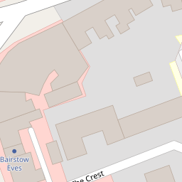


Leaflet © OpenStreetMap contributors
The heatmap indicates the level of crime in the area. The color of the heatmap indicates the crime severity and recency.
Metrics Year-on-Year
- Average area value
- 494,694.00 £Decreased by 3.93 %
- Average area rental value
- 1,770.00 £/moDecreased by 2.43 %
- Est rental Yield
- 4.29 %Increased by 1.42 %
- Crime Rate
- 9.00 %Unchanged by 0.00 %
from 514,950.00 £
from 1,814.00 £/mo
from 4.23 %
from 9.00 %
Nearby Schools
| Name | Type | Ofsted | Distance |
|---|---|---|---|
| Tiferes High School | Other Independent School | Requires improvement | 0.31 KM |
| Hendon School | Academy Converter | Outstanding | 0.36 KM |
| Beth Jacob Grammar School For Girls | Other Independent School | Good | 0.43 KM |
| Brampton College | Other Independent School | 0.43 KM | |
| Bell Lane Primary School | Community School | Requires improvement | 0.60 KM |
Images
Nearby Streets
| Name | Average Price | Average Sqft | Distance |
|---|---|---|---|
| Haley Road | £ 0 | 0 | 0.00 KM |
| Allington Road | £ 1,000,000 | 0 | 0.00 KM |
| Oakfield Court | £ 0 | 0 | 0.00 KM |
| Golders Manor Drive | £ 0 | 0 | 0.00 KM |
| Choral Street | £ 0 | 0 | 0.00 KM |
Nearby Transport
| Name | NLC | TLC | Distance |
|---|---|---|---|
| Hendon | 1522 | HEN | 2.03 KM |
| Cricklewood | 1519 | CRI | 3.09 KM |
| Mill Hill Broadway | 1527 | MIL | 4.42 KM |
| Brondesbury | 1437 | BSY | 4.89 KM |
| Brondesbury Park | 1438 | BSP | 5.07 KM |
Nearby Listings
| Address | Price | Type | Score | Distance |
|---|---|---|---|---|
| Queens Way, Hendon, NW4 | £ 2,950,000 | BUY | Unknown | 0.06 KM |
| Heriot Road, Hendon NW4 | £ 425,000 | BUY | 5 / 10 | 0.06 KM |
| Queens Way, Hendon, London, NW4 | £ 2,550,000 | BUY | 8 / 10 | 0.08 KM |
| Lower Fosters, NW4 | £ 350,000 | BUY | Unknown | 0.10 KM |
| Heriot Road, London | £ 425,000 | BUY | 5 / 10 | 0.12 KM |
Nearby Properties
| Address | Price | Distance |
|---|---|---|
| 21 Heriot Road | £ 483,000 | 0.00 KM |
| 29 Heriot Road | £ 1,180,000 | 0.00 KM |
| 15 Heriot Road | £ 920,000 | 0.00 KM |
| 38a Heriot Road | £ 145,000 | 0.07 KM |
| 40 Heriot Road | £ 42,000 | 0.07 KM |