UN
5 Briston Mews
£ 225,000
Description
We don't have a Description for this property.
- Bedrooms
- 2
- Bathrooms
- 0

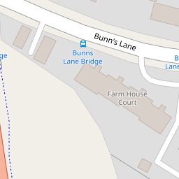

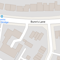

Leaflet © OpenStreetMap contributors
The heatmap indicates the level of crime in the area. The color of the heatmap indicates the crime severity and recency.
Metrics Year-on-Year
- Average area value
- 833,054.00 £Increased by 22.63 %
- Average area rental value
- 2,338.00 £/moDecreased by 38.78 %
- Est rental Yield
- 3.37 %Decreased by 50.07 %
- Crime Rate
- 4.00 %Unchanged by 0.00 %
from 679,349.00 £
from 3,819.00 £/mo
from 6.75 %
from 4.00 %
Nearby Schools
| Name | Type | Ofsted | Distance |
|---|---|---|---|
| Blessed Dominic Catholic Primary School | Voluntary Aided School | Outstanding | 0.63 KM |
| St James' Catholic High School | Voluntary Aided School | Good | 0.64 KM |
| Hasmonean High School For Girls | Academy Converter | 0.70 KM | |
| Copthall School | Academy Converter | Good | 0.78 KM |
| The Orion Primary School | Community School | Outstanding | 0.79 KM |
Images
Nearby Streets
| Name | Average Price | Average Sqft | Distance |
|---|---|---|---|
| Ladysmith Close | £ 697,500 | 0 | 0.00 KM |
| Dove Close | £ 0 | 0 | 0.00 KM |
| Holland Court | £ 0 | 0 | 0.00 KM |
| Woodcroft Avenue | £ 1,025,000 | 0 | 0.00 KM |
| M1 | £ 0 | 0 | 0.00 KM |
Nearby Transport
| Name | NLC | TLC | Distance |
|---|---|---|---|
| Mill Hill Broadway | 1527 | MIL | 1.34 KM |
| Hendon | 1522 | HEN | 2.92 KM |
| Cricklewood | 1519 | CRI | 6.08 KM |
| Elstree And Borehamwood | 1542 | ELS | 6.90 KM |
| Wembley Stadium | 1509 | WCX | 7.72 KM |
Nearby Listings
| Address | Price | Type | Score | Distance |
|---|---|---|---|---|
| Brancaster Drive, Mill Hill, NW7 | £ 550,000 | BUY | 8 / 10 | 0.04 KM |
| Brancaster Drive, Mill Hill, NW7 | £ 625,000 | BUY | 6 / 10 | 0.04 KM |
| Brancaster Drive, Mill Hill, London, NW7 | £ 555,000 | BUY | 7 / 10 | 0.05 KM |
| Brancaster Drive, Mill Hill, London, NW7 | £ 545,000 | BUY | 7 / 10 | 0.05 KM |
| Longfield Avenue, Mill Hill, London, NW7 | £ 670,000 | BUY | 6 / 10 | 0.09 KM |
Nearby Properties
| Address | Price | Distance |
|---|---|---|
| 2 Briston Mews | £ 375,000 | 0.00 KM |
| 3 Briston Mews | £ 400,000 | 0.00 KM |
| 4 Briston Mews | £ 390,000 | 0.00 KM |
| 5 Briston Mews | £ 225,000 | 0.00 KM |
| 6 Briston Mews | £ 123,000 | 0.00 KM |