UN
21 Frinton Road
£ 530,500
Description
We don't have a Description for this property.
- Bedrooms
- 5
- Bathrooms
- 0
- Sqft
- 1,652.00
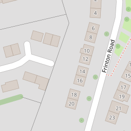

Leaflet © OpenStreetMap contributors
The heatmap indicates the level of crime in the area. The color of the heatmap indicates the crime severity and recency.
Metrics Year-on-Year
- Average area value
- 423,417.00 £Decreased by 4.71 %
- Est sale value
- 868,952.00 £Increased by 51.15 %
- Average area rental value
- 1,573.00 £/moDecreased by 1.75 %
- Est letting value
- 1,652.00 £/moUnchanged by 0.00 %
- Est rental Yield
- 4.46 %Increased by 3.24 %
- Crime Rate
- 13.00 %Unchanged by 0.00 %
from 444,363.00 £
from 574,896.00 £
from 1,601.00 £/mo
from 1,652.00 £/mo
from 4.32 %
from 13.00 %
Nearby Schools
| Name | Type | Ofsted | Distance |
|---|---|---|---|
| Royal Park Primary Academy | Academy Converter | Good | 0.45 KM |
| Hurst Primary School | Academy Converter | Good | 0.96 KM |
| Old Bexley Church Of England School | Academy Converter | Good | 1.24 KM |
| Cleeve Meadow School | Free Schools Special | 1.46 KM | |
| Cleeve Park School | Academy Converter | Requires improvement | 1.46 KM |
Images
Nearby Streets
| Name | Average Price | Average Sqft | Distance |
|---|---|---|---|
| The Ridge | £ 575,000 | 0 | 0.00 KM |
| Tudor Walk | £ 0 | 0 | 0.00 KM |
| East Rochester Way | £ 0 | 0 | 0.00 KM |
| Abbeyhill Road | £ 700,000 | 0 | 0.00 KM |
| Love Lane | £ 0 | 0 | 0.00 KM |
Nearby Transport
| Name | NLC | TLC | Distance |
|---|---|---|---|
| Albany Park | 5132 | AYP | 0.69 KM |
| Bexley | 5093 | BXY | 1.92 KM |
| Sidcup | 5125 | SID | 3.09 KM |
| Bexleyheath | 5094 | BXH | 3.31 KM |
| Barnehurst | 5089 | BNH | 4.64 KM |
Nearby Listings
| Address | Price | Type | Score | Distance |
|---|---|---|---|---|
| Riverside Road, Sidcup, DA14 4PU | £ 450,000 | BUY | 6 / 10 | 0.14 KM |
| Riverside Road, Sidcup | £ 550,000 | BUY | 6 / 10 | 0.14 KM |
| Burnham Road, Sidcup, DA14 | £ 340,000 | BUY | 7 / 10 | 0.20 KM |
| Riverside Road, Sidcup, Kent, DA14 | £ 525,000 | BUY | 8 / 10 | 0.21 KM |
| Davenport Road, Sidcup, DA14 | £ 600,000 | BUY | 6 / 10 | 0.21 KM |
Nearby Properties
| Address | Price | Distance |
|---|---|---|
| 4 Frinton Road | £ 375,000 | 0.00 KM |
| 21 Frinton Road | £ 530,500 | 0.00 KM |
| 7 Frinton Road | £ 354,000 | 0.00 KM |
| 11 Frinton Road | £ 385,000 | 0.01 KM |
| 61 Riverside Road | £ 455,000 | 0.08 KM |