UN
7 Rossdale Drive
£ 380,000
Description
We don't have a Description for this property.
- Bedrooms
- 3
- Bathrooms
- 0

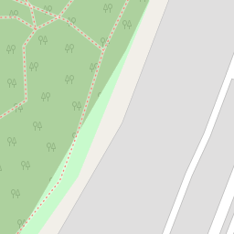

Leaflet © OpenStreetMap contributors
The heatmap indicates the level of crime in the area. The color of the heatmap indicates the crime severity and recency.
Metrics Year-on-Year
- Average area value
- 626,246.00 £Increased by 2.14 %
- Average area rental value
- 2,336.00 £/moIncreased by 26.00 %
- Est rental Yield
- 4.48 %Increased by 23.42 %
- Crime Rate
- 4.00 %Unchanged by 0.00 %
from 613,151.00 £
from 1,854.00 £/mo
from 3.63 %
from 4.00 %
Nearby Schools
| Name | Type | Ofsted | Distance |
|---|---|---|---|
| St Nicholas School | Other Independent School | 0.47 KM | |
| Fryent Primary School | Community School | Good | 0.76 KM |
| Church Lane Children'S Centre | Children's Centre | 0.88 KM | |
| Lycee International De Londres | Other Independent School | 0.89 KM | |
| Willows Children'S Centre | Children's Centre | 1.09 KM |
Images
Nearby Streets
| Name | Average Price | Average Sqft | Distance |
|---|---|---|---|
| Holly Grove | £ 0 | 0 | 0.00 KM |
| Daisy Close | £ 0 | 0 | 0.00 KM |
| Rawlings Crescent | £ 0 | 0 | 0.00 KM |
| Ken Way | £ 365,000 | 0 | 0.00 KM |
| Stewart Close | £ 825,000 | 0 | 0.00 KM |
Nearby Transport
| Name | NLC | TLC | Distance |
|---|---|---|---|
| Wembley Stadium | 1509 | WCX | 2.72 KM |
| Stonebridge Park | 1454 | SBP | 3.17 KM |
| Hendon | 1522 | HEN | 3.38 KM |
| Wembley Central | 1423 | WMB | 3.80 KM |
| Harlesden | 1521 | HDN | 4.08 KM |
Nearby Listings
| Address | Price | Type | Score | Distance |
|---|---|---|---|---|
| NW9 | £ 750,000 | BUY | Unknown | 0.07 KM |
| Hill Drive, Kingsbury London | £ 675,000 | BUY | 7 / 10 | 0.11 KM |
| Salmon Street, London | £ 849,950 | BUY | 7 / 10 | 0.11 KM |
| Hill Drive, Kingsbury, London, NW9 | £ 785,000 | BUY | 6 / 10 | 0.17 KM |
| Lavender Avenue, LONDON | £ 999,950 | BUY | 6 / 10 | 0.19 KM |
Nearby Properties
| Address | Price | Distance |
|---|---|---|
| 7 Rossdale Drive | £ 380,000 | 0.00 KM |
| 17 Rossdale Drive | £ 380,000 | 0.00 KM |
| 1 Rossdale Drive | £ 550,000 | 0.01 KM |
| 23 Rossdale Drive | £ 427,000 | 0.01 KM |
| 3 Rossdale Drive | £ 422,000 | 0.01 KM |