UN
49 Victoria Road
£ 790,000
Description
We don't have a Description for this property.
- Bedrooms
- 4
- Bathrooms
- 0
- Furnished
- true


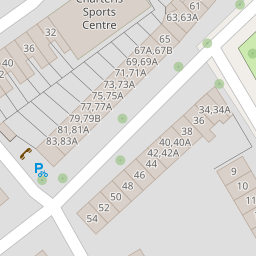


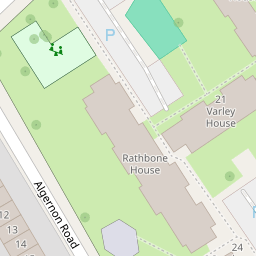

Leaflet © OpenStreetMap contributors
The heatmap indicates the level of crime in the area. The color of the heatmap indicates the crime severity and recency.
Metrics Year-on-Year
- Average area value
- 724,034.00 £Increased by 42.40 %
- Average area rental value
- 2,076.00 £/moIncreased by 10.19 %
- Est rental Yield
- 3.44 %Decreased by 22.70 %
- Crime Rate
- 4.00 %Unchanged by 0.00 %
from 508,459.00 £
from 1,884.00 £/mo
from 4.45 %
from 4.00 %
Nearby Schools
| Name | Type | Ofsted | Distance |
|---|---|---|---|
| Kilburn Grange School | Free Schools | Good | 0.22 KM |
| St Mary'S Rc Primary School | Voluntary Aided School | Good | 0.41 KM |
| Kingsgate Primary School | Community School | Outstanding | 0.52 KM |
| St Eugene De Mazenod Roman Catholic Primary School | Voluntary Aided School | Outstanding | 0.52 KM |
| St Mary'S Kilburn Church Of England Primary School | Voluntary Aided School | Good | 0.53 KM |
Images
Nearby Streets
| Name | Average Price | Average Sqft | Distance |
|---|---|---|---|
| Coral Mews | £ 0 | 0 | 0.00 KM |
| Aldershot Road | £ 0 | 0 | 0.00 KM |
| Kilburn High Road | £ 495,000 | 0 | 0.00 KM |
| Granville Road | £ 0 | 0 | 0.00 KM |
| Mile Walk | £ 0 | 0 | 0.00 KM |
Nearby Transport
| Name | NLC | TLC | Distance |
|---|---|---|---|
| Kilburn High Road | 1415 | KBN | 0.65 KM |
| Brondesbury | 1437 | BSY | 0.86 KM |
| Queens Park (London) | 1419 | QPW | 0.95 KM |
| West Hampstead | 1421 | WHD | 1.22 KM |
| West Hampstead Thameslink | 1525 | WHP | 1.27 KM |
Nearby Listings
| Address | Price | Type | Score | Distance |
|---|---|---|---|---|
| Victoria Road, Queens Park | £ 400,000 | BUY | 7 / 10 | 0.01 KM |
| Victoria Road, Queens Park, London, NW6 | £ 550,000 | BUY | Unknown | 0.01 KM |
| Victoria Road, London, NW6 | £ 600,000 | BUY | 7 / 10 | 0.03 KM |
| Glengall Road, Brondesbury Park | £ 1,200,000 | BUY | Unknown | 0.08 KM |
| Glengall Road, London, NW6 | £ 520,000 | BUY | 5 / 10 | 0.08 KM |
Nearby Properties
| Address | Price | Distance |
|---|---|---|
| 41c Victoria Road | £ 340,000 | 0.00 KM |
| 47a Victoria Road | £ 229,500 | 0.00 KM |
| 59d Victoria Road | £ 271,000 | 0.00 KM |
| 49 Victoria Road | £ 790,000 | 0.00 KM |
| 47d Victoria Road | £ 399,950 | 0.00 KM |