UN
81 Wood Lane
£ 595,000
Description
We don't have a Description for this property.
- Bedrooms
- 3
- Bathrooms
- 0

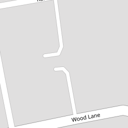

Leaflet © OpenStreetMap contributors
The heatmap indicates the level of crime in the area. The color of the heatmap indicates the crime severity and recency.
Metrics Year-on-Year
- Average area value
- 533,333.00 £Increased by 2.40 %
- Average area rental value
- 1,805.00 £/moDecreased by 14.29 %
- Est rental Yield
- 4.06 %Decreased by 16.29 %
- Crime Rate
- 4.00 %Unchanged by 0.00 %
from 520,811.00 £
from 2,106.00 £/mo
from 4.85 %
from 4.00 %
Nearby Schools
| Name | Type | Ofsted | Distance |
|---|---|---|---|
| Woodfield School | Academy Special Converter | Outstanding | 0.18 KM |
| Oliver Goldsmith Primary School | Community School | Good | 1.15 KM |
| Church Lane Children'S Centre | Children's Centre | 1.16 KM | |
| The Hyde School | Academy Sponsor Led | Outstanding | 1.18 KM |
| Wykeham Children'S Centre | Children's Centre | 1.19 KM |
Images
Nearby Streets
| Name | Average Price | Average Sqft | Distance |
|---|---|---|---|
| Springfield Gardens | £ 750,000 | 0 | 0.00 KM |
| Springfield Gardens | £ 0 | 0 | 0.00 KM |
| Derwent Avenue | £ 650,000 | 0 | 0.00 KM |
| Stewart Close | £ 825,000 | 0 | 0.00 KM |
| Daisy Close | £ 0 | 0 | 0.00 KM |
Nearby Transport
| Name | NLC | TLC | Distance |
|---|---|---|---|
| Hendon | 1522 | HEN | 1.81 KM |
| Stonebridge Park | 1454 | SBP | 4.08 KM |
| Wembley Stadium | 1509 | WCX | 4.12 KM |
| Harlesden | 1521 | HDN | 4.16 KM |
| Mill Hill Broadway | 1527 | MIL | 4.44 KM |
Nearby Listings
| Address | Price | Type | Score | Distance |
|---|---|---|---|---|
| Blair Avenue, Kingsbury, London, NW9 | £ 750,000 | BUY | 6 / 10 | 0.06 KM |
| Blair Avenue, Kingsbury, NW9 | £ 620,000 | BUY | Unknown | 0.07 KM |
| Blair Avenue, Kingsbury, NW9 | £ 710,000 | BUY | 7 / 10 | 0.09 KM |
| Blair Avenue, Kingsbury, London, NW9 | £ 750,000 | BUY | 6 / 10 | 0.09 KM |
| Winston Avenue, London, NW9 | £ 675,000 | BUY | Unknown | 0.10 KM |
Nearby Properties
| Address | Price | Distance |
|---|---|---|
| 81 Wood Lane | £ 595,000 | 0.00 KM |
| 116 Wood Lane | £ 302,500 | 0.04 KM |
| 118 Wood Lane | £ 440,000 | 0.04 KM |
| 106 Wood Lane | £ 250,000 | 0.04 KM |
| 104 Wood Lane | £ 475,000 | 0.04 KM |