UN
110 Spur Road
£ 560,000
Description
We don't have a Description for this property.
- Bedrooms
- 3
- Bathrooms
- 0
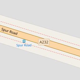

Leaflet © OpenStreetMap contributors
The heatmap indicates the level of crime in the area. The color of the heatmap indicates the crime severity and recency.
Metrics Year-on-Year
- Average area value
- 515,714.00 £Decreased by 11.04 %
- Average area rental value
- 1,870.00 £/moIncreased by 8.03 %
- Est rental Yield
- 4.35 %Increased by 21.51 %
- Crime Rate
- 2.00 %Unchanged by 0.00 %
from 579,739.00 £
from 1,731.00 £/mo
from 3.58 %
from 2.00 %
Nearby Schools
| Name | Type | Ofsted | Distance |
|---|---|---|---|
| Dorton College Of Further Education | Special Post 16 Institution | Good | 0.52 KM |
| St Olave'S And St Saviour'S Grammar School | Voluntary Aided School | Outstanding | 0.62 KM |
| Harris Academy Orpington | Academy Sponsor Led | Requires improvement | 1.25 KM |
| Blenheim Children And Family Centre | Children's Centre | 1.30 KM | |
| Harris Primary Academy Orpington | Academy Sponsor Led | Good | 1.33 KM |
Images
Nearby Streets
| Name | Average Price | Average Sqft | Distance |
|---|---|---|---|
| Lych Gate Road | £ 300,000 | 0 | 0.00 KM |
| Vinson Close | £ 0 | 0 | 0.00 KM |
| Cranleigh Close | £ 0 | 0 | 0.00 KM |
| Elmcroft Road | £ 400,000 | 0 | 0.00 KM |
| Tower Close | £ 950,000 | 0 | 0.00 KM |
Nearby Transport
| Name | NLC | TLC | Distance |
|---|---|---|---|
| Orpington | 5122 | ORP | 1.71 KM |
| Chelsfield | 5098 | CLD | 1.82 KM |
| St Mary Cray | 5073 | SMY | 2.54 KM |
| Petts Wood | 5123 | PET | 3.80 KM |
| Knockholt | 5109 | KCK | 4.12 KM |
Nearby Listings
| Address | Price | Type | Score | Distance |
|---|---|---|---|---|
| Felstead Road, Orpington, BR6 | £ 950,000 | BUY | 8 / 10 | 0.11 KM |
| Lancing Road, Orpington | £ 534,000 | BUY | 6 / 10 | 0.18 KM |
| Lancing Road, Orpington | £ 620,000 | BUY | 7 / 10 | 0.19 KM |
| Hillcrest Road, Orpington, BR6 | £ 650,000 | BUY | 6 / 10 | 0.20 KM |
| Felstead Road, Orpington | £ 615,000 | BUY | 7 / 10 | 0.23 KM |
Nearby Properties
| Address | Price | Distance |
|---|---|---|
| 96 Spur Road | £ 510,000 | 0.00 KM |
| 68 Spur Road | £ 363,000 | 0.00 KM |
| 84 Spur Road | £ 330,000 | 0.00 KM |
| 108 Spur Road | £ 435,000 | 0.00 KM |
| 110 Spur Road | £ 560,000 | 0.00 KM |