UN
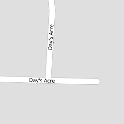
9 Days Acre
£ 370,000
Description
We don't have a Description for this property.
- Bedrooms
- 3
- Bathrooms
- 0


Leaflet © OpenStreetMap contributors
The heatmap indicates the level of crime in the area. The color of the heatmap indicates the crime severity and recency.
Metrics Year-on-Year
- Average area value
- 779,634.00 £Decreased by 11.20 %
- Average area rental value
- 1,765.00 £/moDecreased by 2.75 %
- Est rental Yield
- 2.72 %Increased by 9.68 %
- Crime Rate
- 1.00 %Unchanged by 0.00 %
from 877,978.00 £
from 1,815.00 £/mo
from 2.48 %
from 1.00 %
Nearby Schools
| Name | Type | Ofsted | Distance |
|---|---|---|---|
| Ridgeway Primary School | Community School | Good | 0.22 KM |
| Gresham Primary School | Community School | Good | 1.34 KM |
| Purley Oaks Children'S Centre | Children's Centre Linked Site | 1.62 KM | |
| St Peter'S Primary School | Academy Converter | Good | 1.63 KM |
| Purley Oaks Primary School | Community School | Good | 1.70 KM |
Images
Nearby Streets
| Name | Average Price | Average Sqft | Distance |
|---|---|---|---|
| White Hill | £ 0 | 0 | 0.00 KM |
| Magdala Road | £ 0 | 0 | 0.00 KM |
| Mountwood Close | £ 312,143 | 0 | 0.00 KM |
| Ferns Close | £ 578,950 | 0 | 0.00 KM |
| Addington Road | £ 305,865 | 0 | 0.00 KM |
Nearby Transport
| Name | NLC | TLC | Distance |
|---|---|---|---|
| Sanderstead | 5433 | SNR | 1.21 KM |
| Purley Oaks | 5430 | PUO | 1.73 KM |
| Riddlesdown | 5432 | RDD | 2.20 KM |
| South Croydon | 5410 | SCY | 2.35 KM |
| Kenley | 5419 | KLY | 2.91 KM |
Nearby Listings
| Address | Price | Type | Score | Distance |
|---|---|---|---|---|
| Southcote Road, Sanderstead | £ 685,000 | BUY | 6 / 10 | 0.09 KM |
| Ellenbridge Way, South Croydon, CR2 0EW | £ 850,000 | BUY | 8 / 10 | 0.19 KM |
| Elmfield Way, South Croydon, CR2 | £ 1,250,000 | BUY | 8 / 10 | 0.22 KM |
| Ellenbridge Way, South Croydon, CR2 0EW | £ 750,000 | BUY | 7 / 10 | 0.22 KM |
| Hook Hill, Sanderstead, Surrey, CR2 0LB | £ 1,300,000 | BUY | 7 / 10 | 0.30 KM |
Nearby Properties
| Address | Price | Distance |
|---|---|---|
| 4 Days Acre | £ 490,000 | 0.00 KM |
| 7 Days Acre | £ 755,000 | 0.00 KM |
| 9 Days Acre | £ 370,000 | 0.00 KM |
| 11 Southcote Road | £ 550,000 | 0.08 KM |
| 4 Southcote Road | £ 790,000 | 0.08 KM |