UN
8 The Green
£ 117,000
Description
We don't have a Description for this property.
- Bedrooms
- 5
- Bathrooms
- 0
- Furnished
- true
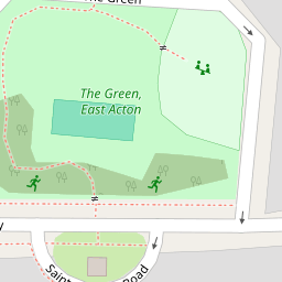
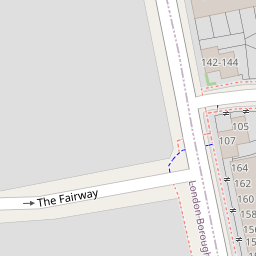

Leaflet © OpenStreetMap contributors
The heatmap indicates the level of crime in the area. The color of the heatmap indicates the crime severity and recency.
Metrics Year-on-Year
- Average area value
- 538,052.00 £Decreased by 8.93 %
- Average area rental value
- 2,337.00 £/moIncreased by 17.56 %
- Est rental Yield
- 5.21 %Increased by 28.96 %
- Crime Rate
- 4.00 %Unchanged by 0.00 %
from 590,816.00 £
from 1,988.00 £/mo
from 4.04 %
from 4.00 %
Nearby Schools
| Name | Type | Ofsted | Distance |
|---|---|---|---|
| John Perryn Primary School | Community School | Good | 0.37 KM |
| King Fahad Academy | Other Independent School | 0.74 KM | |
| East Acton Primary School | Community School | Good | 0.88 KM |
| Old Oak Primary School | Community School | Good | 0.94 KM |
| Old Oak Community And Children'S Centre | Children's Centre | 1.04 KM |
Images
Nearby Streets
| Name | Average Price | Average Sqft | Distance |
|---|---|---|---|
| St. Andrews Road | £ 0 | 0 | 0.00 KM |
| Taylor's Green | £ 0 | 0 | 0.00 KM |
| Union Way | £ 0 | 0 | 0.00 KM |
| Atlas Road Logistics Tunnel (HS2) | £ 0 | 0 | 0.00 KM |
| Atlas Road | £ 0 | 0 | 0.00 KM |
Nearby Transport
| Name | NLC | TLC | Distance |
|---|---|---|---|
| Acton Central | 1404 | ACC | 1.59 KM |
| Acton Main Line | 3000 | AML | 1.60 KM |
| Willesden Junction | 1457 | WIJ | 1.80 KM |
| Harlesden | 1521 | HDN | 2.09 KM |
| South Acton | 1452 | SAT | 2.86 KM |
Nearby Listings
| Address | Price | Type | Score | Distance |
|---|---|---|---|---|
| Long Drive, London, W3 | £ 975,000 | BUY | Unknown | 0.12 KM |
| Mashie Road, W3 | £ 675,000 | BUY | Unknown | 0.19 KM |
| The Approach, London, W3 | £ 725,000 | BUY | 6 / 10 | 0.21 KM |
| St. Andrews Road, London | £ 700,000 | BUY | 7 / 10 | 0.24 KM |
| 107 Fitzneal Street, East Acton, London, W12 | £ 410,000 | BUY | 4 / 10 | 0.26 KM |
Nearby Properties
| Address | Price | Distance |
|---|---|---|
| 8 The Green | £ 117,000 | 0.00 KM |
| 1 The Green | £ 275,000 | 0.00 KM |
| 24 The Green | £ 1,500,000 | 0.00 KM |
| 31 The Green | £ 925,000 | 0.00 KM |
| 27 The Green | £ 265,000 | 0.00 KM |