UN
1 The Dell
£ 360,000
Description
We don't have a Description for this property.
- Bedrooms
- 4
- Bathrooms
- 0
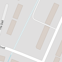

Leaflet © OpenStreetMap contributors
The heatmap indicates the level of crime in the area. The color of the heatmap indicates the crime severity and recency.
Metrics Year-on-Year
- Average area value
- 397,727.00 £Decreased by 3.35 %
- Average area rental value
- 1,670.00 £/moDecreased by 11.69 %
- Est rental Yield
- 5.04 %Decreased by 8.53 %
- Crime Rate
- 8.00 %Unchanged by 0.00 %
from 411,526.00 £
from 1,891.00 £/mo
from 5.51 %
from 8.00 %
Nearby Schools
| Name | Type | Ofsted | Distance |
|---|---|---|---|
| Gallions Mount Primary School | Community School | Good | 0.51 KM |
| Plumstead Children'S Centre | Children's Centre Linked Site | 0.61 KM | |
| St Thomas A Becket Roman Catholic Primary School | Voluntary Aided School | Good | 0.90 KM |
| Bannockburn Primary School | Community School | Outstanding | 1.03 KM |
| Abbey Wood Children'S Centre | Children's Centre | 1.05 KM |
Images
Nearby Streets
| Name | Average Price | Average Sqft | Distance |
|---|---|---|---|
| Prestwood Close | £ 465,000 | 0 | 0.00 KM |
| Radnor Crescent | £ 0 | 0 | 0.00 KM |
| Brimpsafield Close | £ 450,000 | 0 | 0.00 KM |
| Radial Path | £ 0 | 0 | 0.00 KM |
| Yew Tree Close | £ 455,000 | 0 | 0.00 KM |
Nearby Transport
| Name | NLC | TLC | Distance |
|---|---|---|---|
| Welling | 5128 | WLI | 2.11 KM |
| Abbey Wood | 5131 | ABW | 2.16 KM |
| Plumstead | 5208 | PLU | 2.21 KM |
| Falconwood | 5137 | FCN | 3.81 KM |
| Woolwich Arsenal | 5152 | WWA | 3.83 KM |
Nearby Listings
| Address | Price | Type | Score | Distance |
|---|---|---|---|---|
| Glendown Road, Abbey Wood, SE2 | £ 550,000 | BUY | 7 / 10 | 0.07 KM |
| South Gipsy Road, Welling, DA16 | £ 425,000 | BUY | 7 / 10 | 0.07 KM |
| Bastion Road, Abbey Wood | £ 400,000 | BUY | 4 / 10 | 0.15 KM |
| Bastion Road, London | £ 475,000 | BUY | 6 / 10 | 0.17 KM |
| Wickham Lane, Abbey Wood, SE2 | £ 450,000 | BUY | 6 / 10 | 0.18 KM |
Nearby Properties
| Address | Price | Distance |
|---|---|---|
| 14 The Dell | £ 340,000 | 0.00 KM |
| 2 The Dell | £ 175,100 | 0.00 KM |
| 12 The Dell | £ 85,000 | 0.00 KM |
| 1 The Dell | £ 360,000 | 0.00 KM |
| 11 The Dell | £ 195,000 | 0.00 KM |