UN
51b Graham Road
£ 860,000
Description
We don't have a Description for this property.
- Bedrooms
- 3
- Bathrooms
- 0

Leaflet © OpenStreetMap contributors
The heatmap indicates the level of crime in the area. The color of the heatmap indicates the crime severity and recency.
Metrics Year-on-Year
- Average area value
- 690,000.00 £Decreased by 4.46 %
- Average area rental value
- 2,884.00 £/moIncreased by 29.68 %
- Est rental Yield
- 5.02 %Increased by 35.68 %
- Crime Rate
- 3.00 %Unchanged by 0.00 %
from 722,200.00 £
from 2,224.00 £/mo
from 3.70 %
from 3.00 %
Nearby Schools
| Name | Type | Ofsted | Distance |
|---|---|---|---|
| Inspired Directions School | Other Independent Special School | Good | 0.56 KM |
| Brook Satellite Children'S Centre | Children's Centre Linked Site | 0.61 KM | |
| Mossbourne Parkside Academy | Academy Converter | Good | 0.61 KM |
| Mapledene Children'S Centre | Children's Centre | 0.64 KM | |
| Holy Trinity Church Of England Primary School | Voluntary Aided School | Good | 0.65 KM |
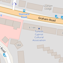
Images
Nearby Streets
| Name | Average Price | Average Sqft | Distance |
|---|---|---|---|
| Ritson Road | £ 1,516,667 | 0 | 0.00 KM |
| Bridge Mews | £ 625,000 | 0 | 0.00 KM |
| St. Philip's Road | £ 0 | 0 | 0.00 KM |
| Electric Avenue | £ 0 | 0 | 0.00 KM |
| Laurel Street | £ 895,000 | 0 | 0.00 KM |
Nearby Transport
| Name | NLC | TLC | Distance |
|---|---|---|---|
| Hackney Downs | 6867 | HAC | 0.78 KM |
| Dalston Junction | 1443 | DLJ | 0.86 KM |
| Dalston Kingsland | 1429 | DLK | 0.95 KM |
| London Fields | 6966 | LOF | 1.20 KM |
| Haggerston | 1022 | HGG | 1.24 KM |
Nearby Listings
| Address | Price | Type | Score | Distance |
|---|---|---|---|---|
| Wilton Way, London, E8 | £ 650,000 | BUY | 5 / 10 | 0.10 KM |
| 23-25, Wilton Way, London, E8 | £ 525,000 | BUY | 7 / 10 | 0.11 KM |
| Wilton Way, London E8 | £ 565,000 | BUY | 6 / 10 | 0.12 KM |
| Ritson Road, Hackney, E8 | £ 1,700,000 | BUY | 7 / 10 | 0.15 KM |
| Massie Road, London E8 | £ 900,000 | BUY | Unknown | 0.17 KM |
Nearby Properties
| Address | Price | Distance |
|---|---|---|
| 47b Graham Road | £ 455,000 | 0.00 KM |
| 3a Graham Road | £ 789,450 | 0.00 KM |
| 49b Graham Road | £ 655,000 | 0.00 KM |
| 47a Graham Road | £ 452,000 | 0.00 KM |
| 51b Graham Road | £ 860,000 | 0.00 KM |