UN
5 Earlsmead
£ 400,000
Description
We don't have a Description for this property.
- Bedrooms
- 3
- Bathrooms
- 0
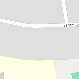


Leaflet © OpenStreetMap contributors
The heatmap indicates the level of crime in the area. The color of the heatmap indicates the crime severity and recency.
Metrics Year-on-Year
- Average area value
- 334,550.00 £Increased by 6.38 %
- Average area rental value
- 1,121.00 £/moIncreased by 0.54 %
- Est rental Yield
- 4.02 %Decreased by 5.41 %
- Crime Rate
- 2.00 %Unchanged by 0.00 %
from 314,486.00 £
from 1,115.00 £/mo
from 4.25 %
from 2.00 %
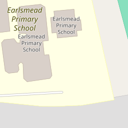
Nearby Schools
| Name | Type | Ofsted | Distance |
|---|---|---|---|
| Earlsmead Primary School | Academy Sponsor Led | Good | 0.10 KM |
| Rooks Heath School | Academy Converter | Good | 0.41 KM |
| Harrow Independent College | Other Independent School | Good | 0.41 KM |
| Heathland School | Academy Converter | 0.60 KM | |
| Northolt High School | Foundation School | Good | 0.81 KM |
Images
Nearby Streets
| Name | Average Price | Average Sqft | Distance |
|---|---|---|---|
| Kenilworth Avenue | £ 0 | 0 | 0.00 KM |
| Hurst Close | £ 645,000 | 0 | 0.00 KM |
| Eastcote Lane North | £ 542,500 | 0 | 0.00 KM |
| Windsor Close | £ 0 | 0 | 0.00 KM |
| Wincanton Crescent | £ 255,000 | 0 | 0.00 KM |
Nearby Transport
| Name | NLC | TLC | Distance |
|---|---|---|---|
| Northolt Park | 1478 | NLT | 1.43 KM |
| South Ruislip | 3057 | SRU | 2.98 KM |
| Greenford | 3136 | GFD | 3.45 KM |
| Sudbury Hill Harrow | 1484 | SDH | 4.04 KM |
| Harrow-On-The-Hill | 598 | HOH | 4.51 KM |
Nearby Listings
| Address | Price | Type | Score | Distance |
|---|---|---|---|---|
| Earlsmead, Harrow | £ 500,000 | BUY | 5 / 10 | 0.02 KM |
| Earlsmead, Harrow | £ 525,000 | BUY | 7 / 10 | 0.02 KM |
| Ludlow Close, Harrow | £ 600,000 | BUY | 6 / 10 | 0.10 KM |
| Carlyon Avenue, South Harrow, Harrow, HA2 | £ 600,000 | BUY | 5 / 10 | 0.14 KM |
| Carlyon Avenue, Harrow, Middlesex | £ 600,000 | BUY | 7 / 10 | 0.17 KM |
Nearby Properties
| Address | Price | Distance |
|---|---|---|
| 19 Earlsmead | £ 510,000 | 0.00 KM |
| 13 Earlsmead | £ 435,000 | 0.00 KM |
| 41 Earlsmead | £ 560,000 | 0.00 KM |
| 5 Earlsmead | £ 400,000 | 0.00 KM |
| 53 Earlsmead | £ 450,000 | 0.00 KM |