UN
34 Beauly Way
£ 465,000
Description
We don't have a Description for this property.
- Bedrooms
- 3
- Bathrooms
- 0

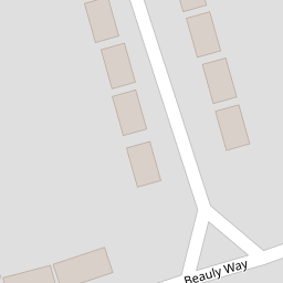


Leaflet © OpenStreetMap contributors
The heatmap indicates the level of crime in the area. The color of the heatmap indicates the crime severity and recency.
Metrics Year-on-Year
- Average area value
- 450,015.00 £Increased by 11.82 %
- Average area rental value
- 1,360.00 £/moDecreased by 3.41 %
- Est rental Yield
- 3.63 %Decreased by 13.57 %
- Crime Rate
- 1.00 %Unchanged by 0.00 %
from 402,439.00 £
from 1,408.00 £/mo
from 4.20 %
from 1.00 %
Nearby Schools
| Name | Type | Ofsted | Distance |
|---|---|---|---|
| Marshalls Park Academy | Academy Converter | Good | 0.47 KM |
| Rise Park Junior School | Academy Sponsor Led | Good | 0.56 KM |
| Rise Park Infant School | Academy Converter | Good | 0.56 KM |
| St Peter'S Catholic Primary School | Voluntary Aided School | Outstanding | 1.13 KM |
| St Edward'S Church Of England Voluntary Aided Primary School | Voluntary Aided School | Good | 1.18 KM |
Images
Nearby Streets
| Name | Average Price | Average Sqft | Distance |
|---|---|---|---|
| Eastern Avenue East | £ 400,000 | 0 | 0.00 KM |
| The Drive | £ 350,000 | 0 | 0.00 KM |
| The Drive | £ 531,250 | 0 | 0.00 KM |
| Park Drive | £ 748,333 | 0 | 0.00 KM |
| Cook's Close | £ 425,000 | 0 | 0.00 KM |
Nearby Transport
| Name | NLC | TLC | Distance |
|---|---|---|---|
| Romford | 6886 | RMF | 2.15 KM |
| Gidea Park | 6877 | GDP | 2.92 KM |
| Emerson Park | 7473 | EMP | 5.03 KM |
| Harold Wood | 6879 | HRO | 5.59 KM |
| Chadwell Heath | 6874 | CTH | 6.60 KM |
Nearby Listings
| Address | Price | Type | Score | Distance |
|---|---|---|---|---|
| Dee Way, Rise Park, RM1 | £ 650,000 | BUY | Unknown | 0.17 KM |
| Clyde Way, Romford, RM1 | £ 500,000 | BUY | 7 / 10 | 0.21 KM |
| Beauly Way, Romford, RM1 | £ 595,000 | BUY | 6 / 10 | 0.23 KM |
| Pettits Lane North, Romford, RM1 | £ 650,000 | BUY | 7 / 10 | 0.25 KM |
| Raphael Court, Romford, RM1 | £ 270,000 | BUY | 5 / 10 | 0.26 KM |
Nearby Properties
| Address | Price | Distance |
|---|---|---|
| 21 Beauly Way | £ 560,000 | 0.00 KM |
| 28 Beauly Way | £ 86,000 | 0.00 KM |
| 22 Beauly Way | £ 340,000 | 0.00 KM |
| 34 Beauly Way | £ 465,000 | 0.00 KM |
| 3 Beauly Way | £ 240,000 | 0.02 KM |